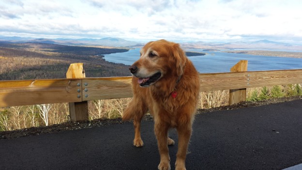
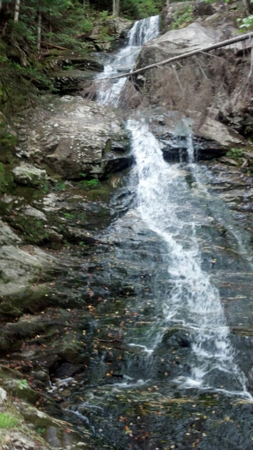
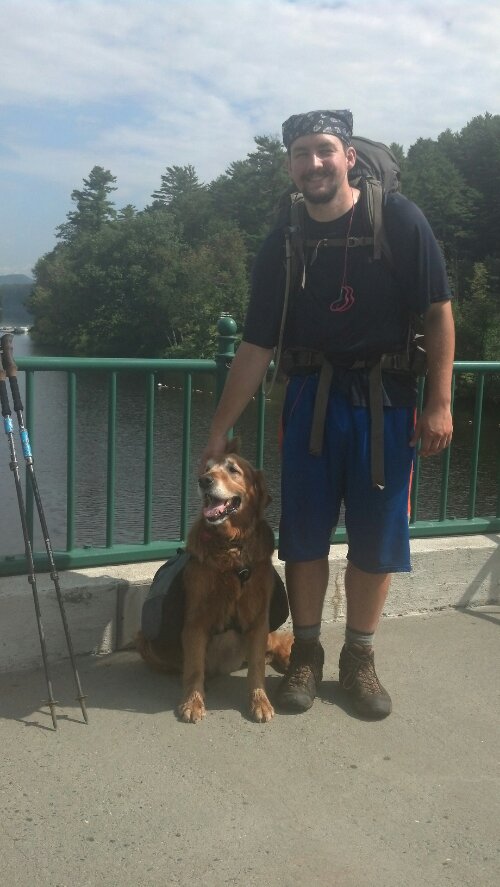
During our 45-minute meeting on the side of the road, as action-packed as it was, my parents had a few moments to spare a word or two about the cottages they’d been in the past two nights (and in which I would spend that night). They sounded nice, but I was a hiking fool. I looked and smelled like I needed a shower, but I felt rested and energized and ready to hike my greasy head across another 13 mile stretch. The range of elevations would be only 1300 feet, with the change spread out over the whole day, and I was ready for an easy day. (Compare this with the multiple 2500 foot elevation changes of the previous day.) In fact, it would be even easier than it looked: the terrain was downright pleasant.
Tag Archives: #slackpack
Speed-running Southern Maine Part 1
144 miles left to go in Maine and a plan to do it in 9 days. That’s an average of 16 miles a day. In Maine. Crazy right? The are three reasons that is even imaginable (let alone possible), any two of which would not be sufficient to put such a plan on the radar:
- I’d nearly hiked 2000 miles already, and was in the best hiking shape of my life.
- Copper wouldn’t be with me for any of it.
- I could slackpack most of it, and sleep in a proper bed most nights.
Attempting 16 mile days every day for 9 days straight while climbing the steepest hills on the A.T. with a full pack, or with a dog, or on untested legs would be something only attempted by crazy professional hikers, crazy people, or Renea. But in my very particular situation, it seemed doable, and doing it is the subject of this post. Continue reading
Ford Escape: Hundred Mile Wilderness
This is a REALLY LONG POST. I recommend spreading out reading it over a few days. Or, you know, just skim it and look at the pictures. I won’t know the difference. I’m not even sure who all is reading these days. You all look like bars on a graph to me.
It was quite late in the day to be starting my first day into the hundred mile wilderness, given that I only had 7 days worth of food for Copper and me. (Yes, I was carrying half of his food to begin with, in a large bag. He carried in Tupperware, which, since his bowl had gone missing on Mt. Adams, he could eat out of) I needed to make ten miles to the Wilson Valley Lean-To before I slept if I were to stay on schedule. And not staying on schedule was not an option when you the trek ahead means crossing an under-trafficked logging road only every other day. The problem was, the trail doesn’t wait until after the first day to start throwing you in front of things worth taking pictures of.
For instance, right past the warning sign, I already reached the first pond of the wilderness: Spectacle Pond. All the ponds out here are scenic, so I succumbed to my urge to move quickly, and skipped the picture. An hour and two more ponds later, I dropped down a steep hill and landed at Leeman Brook Lean-to, where most of the hikers leaving that day had already gathered, some to snack, some just to chat, and some to have a safety meeting. Among the hikers already there were Counselor, Wonder Boy, and Piper. (The latter two may have been largely responsible for the safety material.) Continue reading
Easing Into Maine . . . Before Racing Across It
As I just mentioned, the southern part of Maine is known as the most rugged part of the A.T. From the day I left Gorham, it took me three days to do the first 26 miles in the Mahoosucs to Grafton Notch, where I arranged, while at the White Mountains Lodge, for my parents to pick me up. Since it was the beginning of October (this post begins with the 29th of September), I had no other chance to make the Kennebec River crossing or be guaranteed a chance to climb Katahdin if I didn’t skip ahead and do it before most of Maine. Also, I could do the rest of Maine a lot faster without a dog and a pack, and given that there was almost no one left on the trail this far back, I had no reason to draw out my trip any longer. It was time to get a move on. So, this was the plan: get to Grafton Notch, ride to Caratunk, do the Kennebec crossing, ride to Monson, do the 100 mile wilderness and Katahdin, and then slackpack the rest of the state southbound in nine days, before driving back south to do North Carolina and Georgia. It was to be a whirlwind tour of Maine, to be completed (I hoped) before it started snowing. This post should bring the story as far as Monson, after which I expect the story can be finished in just four more posts. So close!
Beeline for the Treeline
I was one of the first out of bed that morning at Hikers Welcome Hostel. I was in the lounge before the pancakes were. I ate as much of what looked good as I could get my hands on, and made sure my slackpack was packed and the rest of my gear squared away to catch the first shuttle to the other side of Moosilauke.
The weather was actually pretty good for climbing a four-thousand footer that morning. There was fog and cloud early on, but it was clear by the time Copper and I hit the trail and started climbing. It stayed cloudy all day, but it didn’t rain until the afternoon, and was just gorgeous through the hiking part of the day.
The AT runs right past a parking lot at Kinsman Notch, so Copper was already on the trail before I had gotten out of the car and put my fanny pack (which detaches from my pack) on. He was trying to go north though. I called him back, and soon we were walking alongside the Beaver Brook.
Moosilauke doesn’t play around. Going southbound, you start climbing almost immediately, and the trail literally climbs the edge of the waterfalls, perhaps somewhat like the Panther Creek Falls Trail in North Georgia, only steeper and more popular.
The Easy Part
It took me the better part if a month to get through New Hampshire, because there is no doubt that it was the most grueling section of trail I hiked, not necessarily because the trail was the hardest trail I hiked(it was the second hardest), but because it was the hardest trail Copper hiked. I will not deny that the Whites are a major challenges when stacked up against any section of trail further South: as high as the Smokeys, as rapid in elevation change as southern New York, as rocky (at times) as Pennsylvania, the worst weather in the world (in some places), and as little chance to truly prepare for this challenge as for hiking the trail in the first place. On the other hand, I can’t deny that when they are good, they are absolutely flabbergastingly amazingly mind-bogglingly thought-stoppingly astounding—the highest highs and the lowest lows. I have no idea how anyone ever decides to do the trail Southbound, to attempt Maine and the Whites on fresh legs, and worse, to “eat dessert first” and end with the rather uninteresting-in-comparison Georgia terrain. Rollercoasters have to start with the best and end with the least, but if we had our druthers, would we not choose to do it in reverse?
But I can’t say that all of this assessment is retrospect. The few Southbounders and previous hikers freely talked about how amazing—and how difficult—the Whites would be, and by the time I rolled into Hanover, I was practically gushing over with excitement at how close I was. Less than a week from that moment, I knew I’d already be on Moosilauke, and bagging my first 4000-footer in the Whites. And I knew my pace would be slowing dramatically.
But I also knew it’d been days since my last shower, and that I would be in this town for two more days at least. Might as well take the time to mentally prepare myself for the challenges ahead. Eat some good hot food. Do some slackpacking. Drink a beer. Or two. Or three. Maybe hang out with Six and Dangerpants, whom I knew had gotten there ahead of me. In some sense, I guessed that I had never truly hiked before, even after some 1400 miles, based on what people were saying. That one can’t really say “I’m a long-distance hiker” and be taken seriously until the Whites are behind them, but I hadn’t really internalized it. The excitement was forefront. Now that I’ve done it, I can say: I know that I know that I know that it’s true.
I wasn’t the only one crossing that bridge into New Hampshire at that particular time and place, but I can’t pin down for certain who it was. It might have been High Tide and Blockade Runner again. Or it may have been random non-hiker strangers. Either way, they were nice enough to take our picture.
Almost Heaven: West Virginia, Blue Ridge Parkway, Shenandoah NP
This is probably going to be a long post. It covers a week and a half, but all that went by very fast because I hardly stopped for anything, so I doubt my part will be particularly long, but when added to my mom’s account it will surely add up.
So, of course I slept late the day after I was picked up in Rockfish Gap. I barely caught the tail end of the included breakfast buffet at the Residence Inn. I had thought to walk 15 miles this day from Wildcat Ridge trailhead, but it was so late by then time we got into the park, I shortened it to 10 miles. I think I was dropped off at Sawmill Run Overlook at around 1pm to slack the 10 miles back to Rockfish Gap by 6pm. Very little happened aside from the walking, which, as the south end of the park is so narrow, mostly ran adjacent to (and frequently crossed) the Skyline Drive. The Skyline Drive is actually the same road as the Blue Ridge Parkway, having been built as part of the same project in the same fashion, but for some reason it gets a different name while it is inside the park.
I stopped in to Calf Mountain Shelter to eat the leftover pizza I’d packed in, and found the fire going, which I knew meant that Cody Coyote would be there cooking lunch. I managed to catch up to him because someone had gifted him a large quantity of alcohol and so he had holed up in the abandoned motel at Rockfish Gap until such time as the alcohol had all been drunk, which meant about four consecutive zeros for him. This is why he goes no faster than me despite doing nothing but twenties when hiking.
On my way out, I bumped into Lauren, who you may recall I spent the night with in Iron Mountain Shelter. I asked her how she felt, because I’d read her account of her and Sweet Tea’s bout with the stomach bug in the Wolfe shelter log. They’d had to zero there because of it, and she zeroed again in Waynesboro to recover. She still looked a bit worse for the wear, and I didn’t want to touch her since some strains leave one contagious for up to two weeks, but I have to admit I was somewhat glad to actually be catching up to people I thought had long since left me behind.
The only other events that marked that day were passing a huge patch of Pink Lady’s Slippers on the back side of Bear Den Mountain (a hill with a cluster of cell towers on top) and passing Broken Pack just before making it back to Rockfish Gap. I hopped back in the car just before it started raining. I only took one photo the whole day:
Winter Is Going: Summer Springs Early for the Falls
I may or may not have mentioned this, but Mary at the Mountain Harbour B&B makes the best breakfasts on the AT. Copper needed a day off to recover from his illness, and that was as good excuse as any to get to participate in this smorgasbord two days in a row.