I was one of the first out of bed that morning at Hikers Welcome Hostel. I was in the lounge before the pancakes were. I ate as much of what looked good as I could get my hands on, and made sure my slackpack was packed and the rest of my gear squared away to catch the first shuttle to the other side of Moosilauke.
The weather was actually pretty good for climbing a four-thousand footer that morning. There was fog and cloud early on, but it was clear by the time Copper and I hit the trail and started climbing. It stayed cloudy all day, but it didn’t rain until the afternoon, and was just gorgeous through the hiking part of the day.
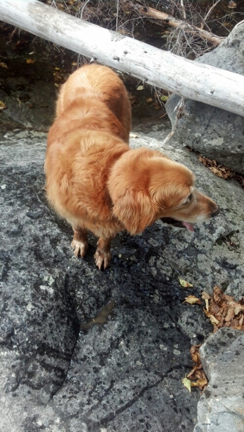
The AT runs right past a parking lot at Kinsman Notch, so Copper was already on the trail before I had gotten out of the car and put my fanny pack (which detaches from my pack) on. He was trying to go north though. I called him back, and soon we were walking alongside the Beaver Brook.
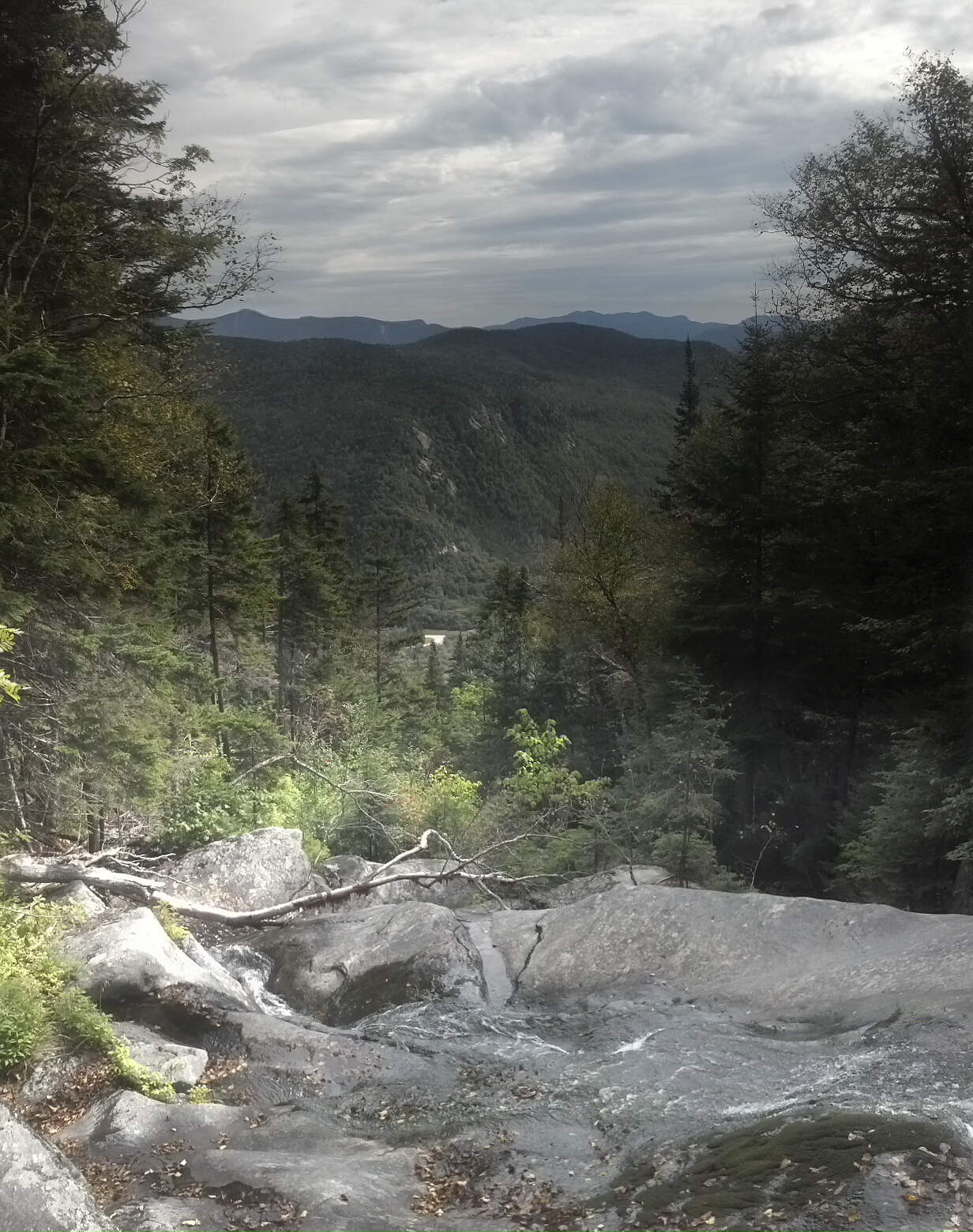
Moosilauke doesn’t play around. Going southbound, you start climbing almost immediately, and the trail literally climbs the edge of the waterfalls, perhaps somewhat like the Panther Creek Falls Trail in North Georgia, only steeper and more popular.


At some places, the trail goes straight up rock faces, and wooden blocks, cut in half diagonally, have been bolted onto the face to make it easier to walk up without slipping. It’s a lot of fun. There was a pair of girls climbing at the same time as us thru-hikers that Packrat had dropped, and they seemed like they’d be exhausted by all the climbing and leery of the edges. I walked out into the waterfall/brook whenever I got the chance for better pictures.


Because trees didn’t grow in the brook, the middle of the watercourse was the best place to get views of the countryside.
Eventually, it got to the point where the water dwindled and the trail just became a stairmaster built of tiny rocks, constantly teasing about how far it might be to the Beaver Brook Shelter. It finally came around just as I was getting desparate for a privy, although it was such a weird side trail, I might have missed it if I hadn’t been searching for it at every moment. Copper and I took a long snack break at the shelter before finishing the climb.
Pretty shortly after we left, we got above treeline. Which means walking through narrow muddy lanes between low scrubby fir trees that just barely keep the wind off. But it was a warm enough morning I felt the sun more than I did the breeze.
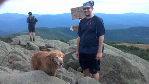
The crowds started picking up as we started to get closer to the top. We were some of the first to come up the way we did that day, but there were plenty more coming right behind us, including dogs. And when we made it to the summit, there were even more, most having come up the easier southern route which I would be descending.
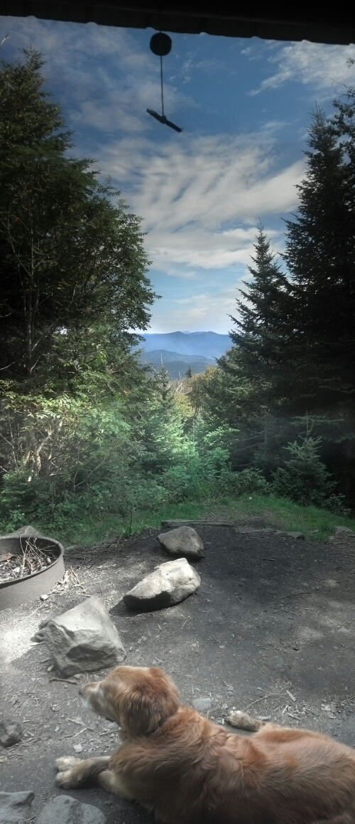
The summit is kind of weird. It’s not a huge plateau. It’s just a narrow hump. In addition to the traditional jags of rock jutting up from the ground, legions of previous visitors had rearrange the rocks into wind shelters that almost seemed to resemble foundations of stone buildings. But they did do wonders for blocking the chill wind, so I claimed one in the name of Blast and Copper. Leaving my poles and bag there, I went over to the summit sign to find someone to take our picture. There were plenty of people to try, so here’s what I got from the random person I picked:
After that, we went back to our claimed spot so I could eat tuna salad crackers and Copper could watch and meet the increasing number of dogs that came up Moosilauke on a perfect day. The pleasantness of the weather made up for the crowds, but soon I’d seen enough, and convinced Copper to come down the other side of the hill.
The hike back to Hikers Welcome would be a lot longer than the one up in terms of miles, though we hardly noticed, because it’s hard to think about much besides the clouds around your head and the mud beneath your feet when you’ve been hiking above treeline.
I knew that rain was expected in the afternoon, so I was hurrying down the hill, through the forests, down the road walks, stopping only when we reached Jeffers Brook Shelter. There was one girl (another Sunshine, I think) already there, who said her hiking partner had decided to spend the evening at the hostel, watching movies and such, while she feel sick and not in any shape to go with him. I ended up sitting in there chatting with her (and reading the logs—here’s where I discovered that I was now 3 days behind Six and Dangerpants, though I thought they’d just left Hanover much sooner than me) until around 4pm, when the rain that had been promised for the afternoon was to supposed to arrive. It started to get sprinkly soon after we left, and we walked back to the hostel, a bit over a mile, in the rain.
In the hostel, they were watching movies again (Dogma this time), so I got a microwaveable dinner and watched with them while I ate. I went to get some additional food out of my own bag, but I found out from Packrat after looking for it that, though I’d hung it above the window upstairs to keep it out of reach of any rodents, he’d moved it outside because it had stunk the place up and other guests were complaining. Vicki had had the same complaint, but I always just thought it smelled like food. (One of the first things I did when I got home was thoroughly bleach that bag; it smells like nothing now.)
I spent some time upstairs opening and packing up the contents of the box Packrat had picked up for me, including certain winter gear, like my zero-degree sleeping bag and my hat and gloves. Then I spent a bit of time blogging, believe it or not, before returning to the festivities. I don’t remember most of who was there besides Quinoa and me, but I do remember this one couple who was doing a long section for their honeymoon. The new bride had received the trail name “Jessie” because, with the cowboy hat she was wearing that night and her braided pigtails, she looked exactly the Toy Story 2 character. They were kind of the center of attention that night. I probably went to bed fairly early again.
The next morning I was up in time for breakfast again, but I was in no hurry. Cop and I weren’t on the first trip back out to Kinsman Notch. In fact, we weren’t even going there. Quinoa and I had to wait for Packrat to finish those slackpack runs so that we could settle up and get a ride to Chet’s Place in Lincoln. Also, I had to prepare another package of unnecessaries (such as my summer sleeping bag) to send home.
It was around midday by the time we got to take the ride to Lincoln (which is apparently enough time to watch most of Good Will Hunting) and my first time at Chet’s. It wasn’t my intention at that point to stay there, as I knew I only had a few things to pick up before I hit the trail, but it didn’t take me long to realize that it would be a bit of a useless day to try to get back to the trail that night. It was Quinoa’s intention to stay right from the outset, as there was a football game he was quite eager to see.
There were a lot of hikers already there. Packrat told us on the way in that he’d come the day before, opened the garage door and said “Some of you I saw here three days ago! Get your packs on and get in the car, your ride to the trail is here! Let’s go! Now!” He knows that this far North, what hikers need is a push every now and then, even though its their tendency to stay in one place that keeps the hostels in business. Chet’s A Step At A Time Hostel is not a business, though. It is run entirely on Chet’s goodwill, tips, and the settlement he got from his accident. As such, it’s really easy to get stuck there, not having to face the White’s unpredictable weather, doing odd jobs for the place and not spending a dime except on town food. Chet doesn’t need them to stay; he needs them to clear out and make room for the next folks, and Packrat provides that service so that Chet doesn’t have to always be the bad guy. Icarus, on the other hand, is firmly committed to doing exactly as much of the trail as he feels like doing, when he feels like doing it, and spending the rest of his time decorating things and slipping surprise bottles of liquor into people’s packs. He answered Packrat’s order with a firm “You’re not my father!” at which point Packrat could only honestly answer “And you’re not exactly the type of person who needs to be bossed around in order to get motivated, are you? That was not addressed to you.”
Nonetheless, in addition the Icarus, the place was full. All the bunk beds and floor mattresses were already claimed. I wouldn’t have wanted to be inside with all those folks there anyway. But I didn’t really socialize yet. I just dropped my pack and put Copper in the backyard.
My first errand was the pizza place with the all-you-can-eat salad bar, which I accessed by borrowing one of Chet’s loaner bikes. I walked there and ate a nothing except salad after salad for half an hour. Next door to that was Zimmerman’s sporting goods, where I bought a few items, including a new platypus to use with my Sawyer filter, because the one I got in Delaware Water Gap had sprung a leak, and silicon seam seal for my tent. From there, I went to the Price Chopper to get, among other things, a cake. I couldn’t get a fancy frosted cake, so I got a cranberry orange pound cake.
Back at Chet’s, a whole bunch of folks, including Quinoa and Damselfly, were playing hackeysack in the backyard, or wrestling and making a lot of racket. There was a bag of wine going around, and who knows what all alcohol. I set up my tent at the end of the yard, crawled inside, and began peeling off seam tape. At some point Damselfly and Quinoa invited themselves into the tent with me to “talk”. Damselfly had heard from Zeke that I was good to talk to, and wanted some conversation of that depth. Unfortunately, she already had enough wine in her to make such an impossibility, and presumably Quinoa was there just because he was hot for her. I got them to pull off some of the seam tape while they were there, and when they decided to wander off and do more fun things, I started painting the sealer over all seams inside and out (but not, unfortunately, those on the rainfly). I finished up, fed Copper, and spent a few minutes arranging my food and supplies.
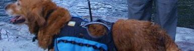
I told you that Icarus was a particularly artful free spirit, so I came up with an impromptu artsy plan involving him. I grabbed some of the Sharpies Chet leaves out for hikers to autograph posters for the hostel wall, and sat down with Copper’s pack to preemptively answer the questions that everyone always wants to know about him: on one side of the pack, I scribed “Hi! My name is Copper!” and on the other “I am ten years old!” (There wasn’t enough room to add “I am a boy!” but I’ve found that the people who actually listen when you tell them your dog’s gender are the minority. Most just use whatever pronoun they’d use for their own favorite dog.) Then, I captured Icarus as he walked by, handing him a Sharpie and asking if he’d decorate the backpack. He agreed, but he pulled out his own metallic-colored Sharpies and decorated it in abstract swirling designs of silver and copper.
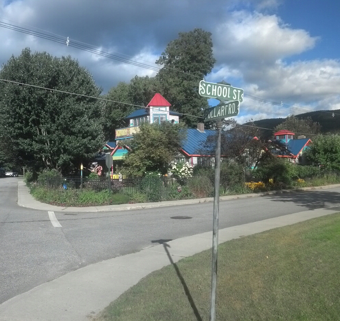
For supper, I went over to the greek place for a gyro, and discovered that it was mildly disappointing for the price, and then I returned to Chet’s place. I took the only picture I took in Lincoln on the way back, of the rainbow house that marks the nearest intersection to Chet’s Place:
After feeding Copper, I went out in the backyard and set up my tent, and then came back to sit on the porch. It was a happening place when I headed back inside. A lot of people were drinking. I ended up sitting up on a top bunk with Enoch and Pop Tart (whose poodle Milla Dog was walking back and forth across the hostel being young, while Copper mostly ignored her), listening to people get rowdy, trying to convince a hiker (whose trailname had been something conventional and unmemorable, but became Bah Hahba that night, because he couldn’t stop shouting random phrases in a Boston accent all night) to settle down and not wake up the neighborhood (or try to drunkenly and depressingly confide in Enoch about war stuff, them both being veterans), and trying to hide the bottle of Jack from both him and Damselfly, who was sprawled on top of Splash on the couch. It was fun for a while, but when I got tired of it, I could just leave it all and head out to my tent.
The next morning when I finally crawled out of my tent, there were already people up and gathered on the back porch. Before I could even get inside, someone warned me that Damselfly had woken up in the middle of the night too drunk to find her way out of the hostel, and had squatted and peed on the carpet next to the refrigerator—right next to where mine and Copper’s bags were located. Fortunately, I think there was not enough sidesplash that any odor was detectable later, but I was rightfully ticked off at first.
I cooled off by walking over to FLAPJACK’S Pancake House, where a line out the door had already formed for breakfast, despite my arrival less than an hour after opening. The wait wasn’t that long since I was alone, and could sit at the bar. While waiting on my pumpkin pancakes and omelette, I watch a Beatles- themed electric train wind its way around an elaborate track encompassing the entire track near the ceiling. FLAPJACK’S is famous in Lincoln for its elaborate oversized pancake breakfasts, but it was once famed for its chowder, as, despite its considerable distance from the sea, it was once a chowder house, until the chef “discovered his grandfather’s old pancake recipe” and decided to take a new (likely more profitable) course. A sign on the side of the building proclaims the prestigious award won by the famed chowder, and samples of the stuff can still be purchased to go. Full to bursting, I returned to the hostel to take down my tent and start getting things together.
Later that morning, I was half-packed when Packrat showed up yet again, dropping someone off, but also offering to carry off the hostel’s trash. Some of us helped load the trash into the truck. Then, Packrat said he could stay for another 15 minutes while I finished getting Copper and me packed, and carry us back to the trail. I had enough food, I thought, to make it all the way from Kinsman Notch to Crawford Notch without stopping, and I saw no since in stalling, when Katahdin was so far away and the weather was so nice. So I ran around like a headless cockroach for a few minutes, throwing things together, dropped a few bucks in Chet’s tip jar (but no coins, as Chet said he just flung the change across the parking lot of the day care center across the street for the kids to find) until finally we could climb in and get our butts back to the trail.
It was like 3pm when we set out that afternoon, and it was a beautiful afternoon. It was uphill the whole way out of Kinsman Notch, except for a very brief downhill before we started Mt. Wolf. Along the ridge of Mt. Wolf is nothing but firs, like the kind you see above treeline, but slightly taller (except where weather and wind and who knows what else has knocked them over and cleared out wide patches) and piles of deep moss.
Near sunset, I found Green Lite and First Gear cooking on a rock slab with a view. I stopped to find out what was up, and they told me they were planning on stealthing right there. I was planning on stealthing on the mountain as well, but I had no intention of erecting my tent on a slanted rock, so I wished them good luck with that and headed on. Less than half a mile up the trail, I found a flat clearing next to the trail surrounded by rock ledges and trees, but big enough for my tent and probably rarely camped on. In short, it was dark and getting cold, and neither Copper nor I felt like continuing, so it was perfect.
In the morning, I woke at dawn and ran off into the woods tripping over piles of branches to tear a hole in the moss, packed as quickly as I could (which is slower than before, as the tent takes longer to pack than the hammock), and got us back on the trail headed downhill to the last free shelter in the White Mountains section of the trail.
We arrived at Eliza Brook Shelter just as it started to rain. It seems like it rained almost every other day that week. I had no intention of stopping there, as the rain was supposed to let up. But I was ready to take the opportunity to lighten my load. You see, Eliza Brook Shelter marked my three-quarters completion point.
(“Ohmigosh,” I hear you thinking. “It’s already March, more than four months since he finished the trail, and he’s still got a quarter of the trip left to document?” Well, yes. Each quarter of the trail took just under two months to hike, and, at my current rate, probably about the same to write down.)
If you have been paying attention so far, I’m sure you can guess exactly what happened next. I sat down in the shelter out of the rain, pulled Copper up in there with me, unpacked the cake from the top of my bag, and proceeded to eat three quarters of it in one go.
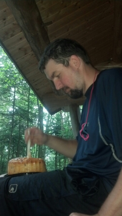
When First Gear and Green Lite showed up, I tried to get them to eat some cake, but apparently, it’s not what they’re into. They were very hard sells, and mostly wanted to eat their own food. I ended up hanging the cake in its grocery bag from one of the mouse hangers.
I went out into the rain to collect some water at the creek that runs past the shelter, and frankly, it felt great. It wasn’t a driving rain, just a misty drizzle. The downside was how humid it made the afternoon.
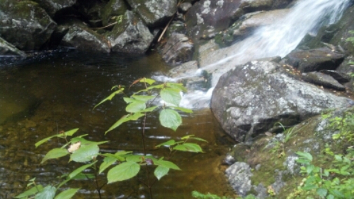
After wasting several hours at the shelter avoiding rain, we finally set off, intending only to surmount Mt. Kinsman, and then probably stay at Kinsman Pond, even if it meant paying a fee. I even told Green Lite and First Gear that was my plan. I didn’t expect that the downfall of this plan would be the first part, since we had five hours of daylight to go four miles, and the profile of Kinsman looked no worse than, say, Stratton or Killington. So we set off up the side of Eliza Brook at a fair pace, stopping only to remember the waterfalls along the way.
Soon, Eliza Brook goes away and we’re climbing straight up the bare rock faces, or over ledges high enough that Copper can’t find any path up on his own. Time after time, I find myself working my way halfway up a crack, planting my feet as best I can with no good handholds around, and, squatting under my pack’s weight, manhandling (doghandling?) Copper up to a ledge ahead of me by the handle on his pack. I notice that one of his claws is bleeding from skittering it across the rocks, wearing it down nearly to the quick. I put one of his boots on that paw, but I have little hope it’ll stay on as we continue the scramble. Copper doesn’t show any pain, though, just joy at making it over each obstacle and to the next higher level. I do my best to conserve my strength by judging which climbs he can make on his own, given enough time and motivation. Although it slows me down waiting for him to search for his own paths around each spot, it’s greatly amusing to me to watch him think and plan his route. He doesn’t get that kind of mental challenge at home, and it’s never too late to teach an old dog new tricks, right?
Hours later, when we finally pull ourselves up and over South Kinsman Peak, the sun has pretty much set, and a thick fog has rolled in. We’ve done 2.5 miles in the last five hours, and we are both completely drained. I find a stealth site north of the peak at the edge of a fir stand in a mossy bowl surrounded by small firs whose branches tear at me while I set up the tent. Though we’re surrounded by trees, we’re still “above treeline”, i.e., in the alpine zone, and its poor trail manners to camp here, but we couldn’t continue that night after climbing a mountain that no one really talks about being as nasty as it is. I wasn’t expecting it. I really should have, though.
While staying at the Hikers Welcome hostel, one lady had sat with Packrat for most of an hour planning her trip through the Whites “to make it easy on my old legs.” I copied her notes into my own guide, and while lying in my tent that night after supper, replanning the next few days, I noticed I had clearly marked the section between Eliza Brook and Kinsman Pond “tough”. Well, now I knew what that meant. And I’d marked two more sections as tough, one of which I’d hoped to be at in two days.
The next day I got up and packed up as quick as I could, knowing it was just 1.5 miles down hill to Kinsman Pond Shelter and its privy, and not really wanting to force any early hikers to have to dance around my tent which was hard by the edge of the trail.
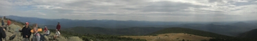
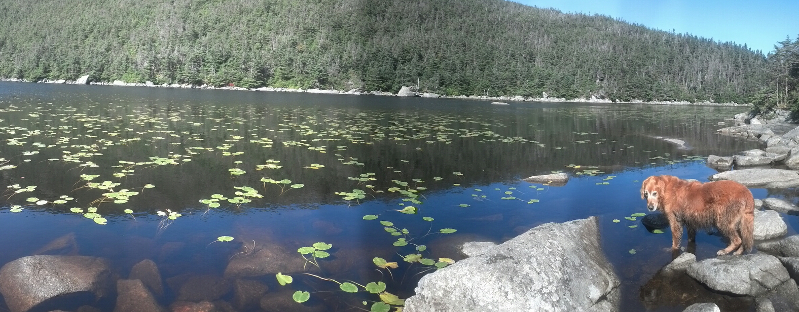
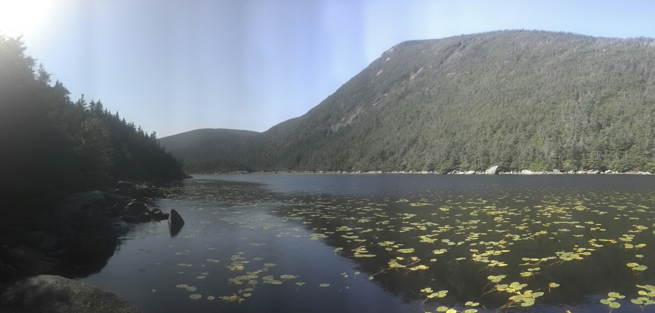
We arrived at Kinsman Pond around 10am, and the pond, the shelter, and the weather were all beautiful. The AMC cleans all graffiti from its shelters to keep them looking new, but this one actually was new. It had just been rebuilt less than a year before, and still had that brown, fresh wood look. And as for the pond and the weather—see for yourself:
I had a plan to make it to Liberty Springs Campsite on the other side of Franconia Notch before the thunderstorm scheduled for that evening, so after an hour, we struck off down the 1.8 miles to our first AMC Hut.
Even though it’s situated in a beautiful location, is open earlier and later in the season, and has been heavily renovated lately, I get the feeling that Lonesome Lake Hut is underappreciated among AMC huts, due to comparatively difficult access (1.5 miles uphill) and being so far west of the more celebrated ranges and regions. Nevertheless, I gathered from the talk of the hut kids and the bustling activity that they were at or near capacity that night. There were no guests inside when I tied up Copper and went inside (I heard they were out hiking around), but there was one girl in the kitchen getting their supper for that night started.
I sat and listened to the radio as I made myself tuna sandwiches. I asked the hut kid if maybe she could spare a tiny squirt of mustard, which they surely kept around in giant institutional containers. She explained that every time they ran out of a food item, that was another box one of the hut kids had to carry up the mountain on his or her back (and the AMC probably wasn’t too fond of the extra expenditure either). I didn’t find this a particularly compelling objection to a single squirt of mustard, but it did seem well-rehearsed. It gave me the impression right off the bat that the AMC huts weren’t too thru-hiker-friendly. Also out of the question was charging my phone from the outlet powering the radio, as all power in the huts comes from solar panels and wind generators, so that allowing any guest to charge their devices would preclude having lights on at night by which to eat supper. I didn’t even bother to ask. Instead of wasting power doing anything with my phone, I found this hut’s copy of Guy and Laura Waterman’s seminal Backwoods Ethics, a copy of which can be found in every hut. I had first heard of it when I saw the caretaker at Sages Ravine reading it a month before, and he’d said its depictions of hikers were hilarious.
I bought some of the sweet bread they had baked and placed out for hikers, and was soon asked by the girl in the kitchen whether I intended to spend the night. I countered by asking whether it seemed likely I could make it to Liberty Springs before the weather hit. She indicated the trail down to Franconia Notch was easy enough, but it was quite a steep climb up the other side to the campsite. I decided to put down the book, pack up and get moving. Staying wasn’t an option anyway, since there was no way I was going to sleep inside a warm kitchen while Copper was tied up under a staircase in the middle of a thunderstorm. If he has to be miserable, then I’m going to be right there next to him.
We left out just before 4pm with 5 miles to go to Liberty Springs Campsite. Just below the hut was Lonesome Lake, where several people (hut kids and friends of hut kids, I think) were swimming in the lake. The trail runs right behind a dam presumably built to keep the trail dry. 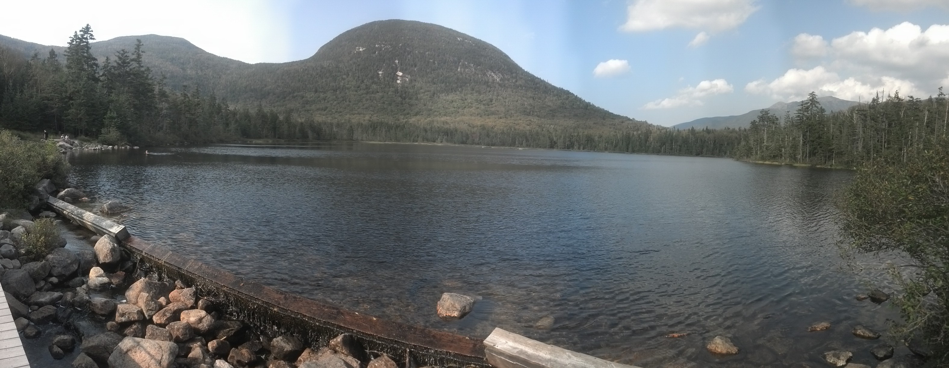
It was here I met the hut-kid-in-chief, whose name I’d seen on the blackboard inside, carrying a fresh load of food up to the hut. She was moving out, by stopped long enough to explain how all the boxes were strapped to the top of the sled above her head because it balanced better and was more comfortable to carry that way.
The trip down to the notch was as easy as promised, following a stream much of the way. There were plenty of people out hiking up to the hut, even that late in the day. A couple of hours later, we walked under the interstate onto a paved trail. We crossed a bridge and soon turned off the trail and headed straight up the side of the hill. A thousand yards, I found myself searching for a way off the trail looking for a spot to pee, since the trail was busy. Just as I finished, a couple with a dog came up the trail. Copper, of course, ran off to visit. A few hundred yards later, the rain started coming down. Facing a mile climb straight uphill in the rain, I turned around on the trail and began diving off the trail left and right looking for level ground. It took coming all the way back down to the notch to find a clear level spot off in the woods within sight of the level trail. I set up the tent in the rain, praying I’d sealed it well enough to let me sleep dry.
Copper, of course, stood up and started panting over my head when the thunder came in, but I tackled him and held him down, and he actually stayed pretty chill the rest of the night. I dozed off to the sound of another Dresden Files and the rain in the trees and on the tent flap. The next morning, I slept in as late as my bowels would allow me, pleased that it was dry inside the tent. When I finally got out of my sleeping bag, the sun had already warmed the woods and the inside of my tent was practically toasty.
Rather than eat a full breakfast that morning, I just had a few snacks, packed up everything except my tent, then left Copper zipped up inside it with his breakfast while I walked the half-mile to the Flume Visitor Center. I didn’t know if the bike trail I was on went right to it, so I took the Pemi Trail into the woods. For being a trail that winds through a thin strip of forest between the paved bike trail and the interstate, it was surprisingly rugged, and the rain had left it covered with puddles. I was hopping back and forth like a gazelle to avoid getting my camp shoes wet, since they do not dry easily.
At the Visitor Center I plugged my phone in, then got in the food line with a huge troop of old folks who’d just climbed off a tour bus. Some of them were brave enough to stand within feet of me. I got a cheeseburger, some coffee, a muffin, and a tube of Starburst (which I did not realize until that very day were the perfect trail food). After I’d eaten my fill, I took my coffee across the lobby to see the free movie about Franconia Notch, but no food or drink were allowed inside, so I left it on a bench outside the theater.
The movie told the complete geological and commercial history of Franconia Notch, including the story of “The Profile”, the unusual rock formation which jutted out from Cannon Mountain, forming the shape of a man’s face, which once could be seen reflected in Profile Lake in the center of the Notch, and their efforts to preserve it before erosion finally won and it inevitably tumbled into the valley in the early 2000s.
But to me, the most interesting thing about the movie was the narrator sounded exactly like Anthony Hopkins as “Bane” in The Dark Night Rises. It was quite the experience to have Bane himself giving a history lesson. Imagine it:
Four million years have shaped this land.
Four million years of erosion.
Of ice and fire from the earth.
Four million years of days.
Rainy days. Sunny days. Snowy, frosty, bitterly cold days.
Days like this day.You think Franconia Notch is your playground.
You merely adopted Franconia Notch.
I was born in it. Etched by it.
I didn’t see a tourist until I was already an Old Man cantilevered over a thousand-foot cliff.
By then, they were nothing to me but annoying (and my days were numbered).So remember, when you see Franconia Notch today, it will never be the same again.
When I came out of the theater after the movie, my coffee had been taken and thrown away. I begged the cashier in the cafeteria for another cup, and she was nice enough to let me get another. I was curious to go look at the famous Flume myself, but they were charging like $25 to go inside it, so when my phone was charged, I took off back up the bike path to my campsite (composing the little ditty above on the way).
Copper was still lying curled up on my sleeping bag when I unzipped the tent, but he hopped to his feet as soon as I opened the flap. He wandered around in the still-damp woods around the site while I packed up camp. It was already afternoon, and we had a steep 2.5 mile rocky staircase to climb in that post-storm humidity to get to Liberty Springs. Since thunderstorms were scheduled for around 4:30 that afternoon and beyond Liberty Springs is nothing but five miles of exposed ridgeline, I’d already decided that that was all we were going to do for the day.
After an interminable climb rising a thousand feet per mile with no switchbacks, we rolled into Liberty Springs Campsite, a row of tent platforms and a single privy arrayed along the side of the mountain across from the eponymous springs. I called out at the caretaker’s tent with no response. So I picked a platform and set up on it, wedging my stakes into the gap. (Only one other person was there so I had my choice. I picked a single-tent platform nearest the privy.)
After fetching water from the spring (which is adjacent to a tree-clogged “overlook”), I tried the caretaker’s tent again with the same result, but this time I caught Hawaii coming up with two other guys, discussing what they would do next. The other two decided to race the thunderstorm to Greenleaf Hut, but I persuaded Hawaii to stay dry in camp with me. She set up her hammock on the group platform across the way. We didn’t talk much, though, because of the storm. I cooked on the platform watching the clouds and hearing the thunder approach, counting the seconds to time it, and then Copper and I were in my tent and Hawaii was in her hammock until morning. I found that I had a good cell signal here, and used it to track the storm. I did a bit of blogging and listened to some Dresden Files too.
And here is where I discovered just how much I hate tent platforms. I’d grown accustomed to sleeping on slabs of wood from staying in shelters, so this was not the problem. The problem was the rain. I’d done my best to stake out tent and rainfly by wedging the stake into cracks and tying off to rings on the side of the platform, but it’s just impossible to get the tension right with such limited choice of stake placement. Since I wasn’t expecting perfect performance from my rainfly, I wrapped my packa over and around it as an extra layer of protection.
The first thing I discovered was that that the rainfly did nothing to stop the rain that was bouncing up from the platform. It would hit the planks next to the vestibule, the fly up underneath the vestibule flaps and through the screen they covered to land on my face. I unzipped in the middle of the driving rain to reach out with one bare arm to try and pull the flap in. Next, I discovered why rainflies are kept under tension: the loose section of my packa that normally encompassed my pack was quite eager to keep water of the tent by catching and holding it like a giant bowl. It wasn’t long before the tent wall was pressed against my forehead with the weight of it. I tried to reach out and push the water out of it so that I could remove it, but the water decided to come out sideways, falling in a thick rivulet straight through the narrow slit I’d unzipped in order to reach out and right into the tent. I snatched the packa down and tossed it aside on the platform.
Next, I learned firsthand that I had indeed made a mistake not resealing my rainfly when I was in Lincoln. There was a leak right at the peak of the tent, under which was another screen section. I reached out again to shove the shirt I’d used to mop the spilled water off the tent floor between the fly and the screen, and ended up tearing off even more seam tape by trying to squeeze the shirt between the tent poles and the fly. But it slowed the dripping enough to get to sleep.
In the morning, I awoke in a pool of water to my alarm going off. The former meant I’d somehow accidentally turned my phone on in the night, and the battery was already as low as if I hadn’t spent the morning at the visitor’s center. (What this means for you is that I took no more pictures for the remainder of the time described in this post.) The latter meant that, although my thermarest had kept most of my sleeping bag dry, nothing else not sealed in a plastic bag had come out undampened. This basically meant my long underwear and nothing else. But, though everything outside was wet, it wasn’t raining. As I started unpacking, I started hanging clothes of all sorts off of branches and trekking poles in hopes they might dry. Having spent the night high and dry, Hawaii got up nearly an hour after me, but finished packing much faster and was on the trail while I was still exploring the campsite and doing errands. Incidentally, during my exploration, I found that there was a dirt site big enough for my tent next to the highest tent pad. Clearly, I should have explored some. Shoving all my wet gear and clothes back into my bag (or worse, putting it back on), I realized that the only upside to my miserable night there was that I hadn’t had to pay the $10 AMC fee.
Just then, the caretaker came wandering back through the campsite to talk to me.
“Huh! I didn’t know you were here. Did you spend the night?”
“Oh, I just came down off the ridge for a minute to use the privy. I’m about to head back up there.”
“Oh, okay. That explains why I didn’t see you come by. I was pretty sure no one had spent the night here . . .”
At least three people had spent the night there in three different campsites. Thank goodness for inefficient caretakers saving me the annoyance of having to pay for the privilege of being absolutely miserable!
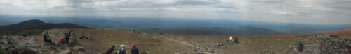
It was still nasty and foggy that morning, but I had high hopes it would clear up later while I was up on Franconia Ridge, as the 5 mile walk above treeline was famed for its beauty. The wind was pushing at the clouds, so I thought it might push them away. Being up in the clouds, though, meant it just pushed them into me. That fast-moving mist chilled me to the bone, even as I moved as quickly as I could across the rock slabs and over the ledges. Just after coming down one of the many small peaks—probably Little Haystack—I gave up and stepped into a little illegal campsite area beside the trail, stripped and put on my last dry clothes: the long underwear.
Less than a mile later, it started raining again.
The terrain above treeline is not easy in the best of conditions, and frequently entail climbing over the sorts of ledges that Copper needs help with (though frequently I was able to leave him to figure out his own route around). And there’s no “bad weather” routes either; there’s a sharp thousand foot drop-off to either side of the ridge. The wind didn’t let up just because the rain had started either. Pretty soon my the right leg of my long underwear was soaked through, while the left leg, on the leeward side, was only halfway there. Copper, on the other hand could just shake the rain off. Here’s a video by another hiker that shows you exactly what I saw that day:
What he couldn’t shake off, however, was his pack. Around the top of Lafayette, I stopped to let him catch up, and noticed he was missing something blue. I had to turn around and go back over the peak and down the ridge. A couple of guys coming toward me said they’d seen his pack on the ground just a little way back. So I walked a half-mile southbound in the rain, thus finally ensuring my left leg got a good soaking too.
I got the pack back on Copper, and we headed back up Lafayette (which, with Lincoln, was our first time above 5000 feet since Mt. Rogers way down in Southern Virginia and 5 months before). There’s a trail there pointing straight down toward Greenleaf Hut, said to be a nice hut, if it weren’t for being a mile off trail. The other sign said Mt. Garfield was a mere 3.5 miles away. I was already soaked through, so how hard could it be? Well, ask a silly question… (Hint: it’s one of the sections I’d labeled “tough” on the map.) I decided we’d press on down the mountain.
Here’s where I discovered how much worse the weather can make the trail above treeline. As the trail comes down the side of Lafayette, it runs around the edge of sheer, steep slabs with water rushing down them in streams. I had to work my way around the edge of it, gripping the corners of boulders to keep from sliding down it. (When asked about the difficulty of finding the trail above treeline, Packrat admitted it was possible, but that one could intuit the direction of the trail by going whichever way the water would flow. Here, I was straining to avoid doing exactly that.)
Copper had no idea what to do in this area, and had utterly vanished from view by the time I navigated this treacherous slab. So, I had to climb back up it, find him, and lead him down. Of course, he’d managed to get his pack off again, and I couldn’t get it back on him either; it wouldn’t hold because he’d chewed through the strap.
Back below treeline (finally!) I stopped in a clearing on the edge of a small pond to sit on a rock and stitch up the pack. It was a welcome respite for my feet, which, quite independently of the soaking they’d received in the Merrells which were so leaky I’d tried to duct tape them back together, were miserably sore. But there were miles to go! So Copper put his pack back on and we trudged on into the drizzle.
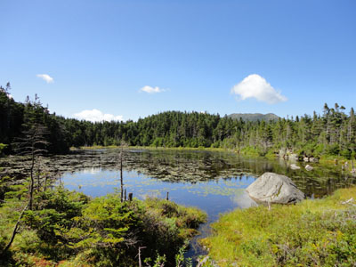
Garfield Pond on a nice day (via FranklinSites.com)
Being below treeline protected us only from the wind, not the wet and cold, nor the harshness of the trail conditions. Indeed, the trail only got worse as we approached Mt. Garfield. It became impassable in many places for Copper, and I was spending half my time coaxing him to find a route so as to avoid lifting him up the slabs and ledges. Yet again, I turn around to see him without his pack. It’s not far down, and he’d chewed through the same strap in a different place. Completely soaked through with the end of day approaching, I choose not to stop and sew it up again, in order to avoid hypothermia risk.
But this creates a new problem. Now I’m carrying a 40 pound pack (because I’d decided we’d be out for an entire week, remember!) over one of the worst sections of trail in a shoddy pair of boots while carrying a 12 pound dog pack and two trekking poles in one hand, so as to leave the other hand free to bodily heft an 85 pound dog up over five foot ledges. You’ll note this leaves me with no hand for to hold on to something for balance in this process. Foot placement is key.
As you can imagine, the last mile did not go by very quickly.
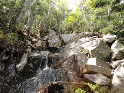
A section of the Garfield Ridge Trail on a nice day (via FranklinSites.com)
Just shy of the top of Mt. Garfield, having no idea how close I was, or how far down the other side I’d have to go to get the Garfield Ridge campsite, I came upon a tart pinned among the trees over a little hollow. An older woman I’d met at Chet’s (or maybe even just earlier that day) had set up a strange stealth camp. She recognized Copper and me, and invited us to stay under there with her, sharing our warmth. She’d clearly had quite as tough a time with it as I’d had, and was as worn out as I felt. With the sun basically gone (as if I’d seen it even once in the last 24 hours!), I took her up on it. It took quite a lot of arranging to get Copper and me in there, and I tried to array my tent around the edges of the tarp on the upwind side to keep out more water. But we were sitting in water. There was nothing under my ground cloth but wet moss. And not everything could be kept off the ground. Plus, it was very inconvenient to sit on a slope under a low-sagging tarp and do almost anything. Walking around the tarp in the dark resulted in kicking the ropes loose, which made me lose her stakes in the moss. I retied them to tree branches. Ducking low enough to crawl under the tarp was hell on knees that had spent the day on rocks. There was exactly one level spot to set my JetBoil to cook supper, and even it tilted a bit. And did I mention how cold it was? The lady whose tarp I shared had wrapped up in every blanket she had, plus an emergency blanket. I was fine with my zero-degree bag as long as I kept it dry, but that mean sleeping naked, since all my clothes were wet.
In the morning, of course, even the sleeping bag had taken on some water, especially in the hood and feet. It wasn’t hard to wake up at first light, since I wasn’t exactly comfortable, having slid down the hill in the night. It was painfully cold out in the world, so I made breakfast before getting out of the bag and, when I did (asking the lady to look away or at least pay for the peep show), then first thing I had to do was clad myself in cold, wet clothes. Quite the way to wake up. In such a state, it was obvious I couldn’t go on hiking, even if I had the supplies for it. I’d already decided to get out of the woods while the getting was good, dry everything out back in Lincoln, and come out again, hopefully in better weather.
With everything wet, my pack was about 10 pounds heavier than usual, and since Copper’s pack was still busted, I had to carry that over Mt. Garfield too. Fortunately, we were so close to the summit, we crested it within a couple of minutes of leaving “camp”. On fresh(ish) legs, we came down the pebble-strewn stone staircase on the other side with ease, passing the Gale River Trailhead en route to the Garfield Ridge Shelter side trail, just a short 500 steps down. It was very steep, but going downhill is not an issue for Copper: he doesn’t mind jumping.
The shelter was full of people when I got there, including the two guys who’d gone ahead to Greenleaf Hut two nights before and I think Hawaii, plus several others. I don’t remember their names or even their faces at this point.
Seeing that I was completely soaked through from underwear out to fleece, the others there were understandably worried about me. I accepted some hot coffee, did some jumping jacks to warm up, visited the privy, then went out to the overlook next to the shelter trail to hopefully call a shuttle to the end of the Gale River Trail. My phone was on the brink of death and the signal was barely there. I managed to get through to a shuttle service after a couple of calls and redirects, and the guy told me he wasn’t actually in a place to schedule at shuttle at that moment, and that he’d half to call me back. After he hung up, I saw my phone was at 2% and turned it off. I didn’t have enough battery to take a call back. I’d have to try to get a lift back from a stranger. (There was an AMC shuttle the campsite caretaker told me about when I talked to him a few minutes later, but he wasn’t sure I’d be able to make it, or if it was even running that weekend. I figured I could make it in time if it was, and set that as a backup plan.)
I returned to the shelter to find that everyone had been so worried about my condition, they had freaked out a little bit while I was gone so long, wondering if I’d left without my gear, wandered off a cliff and fell to my death. Not an implausible scenario to be sure, but I wished they weren’t so anxious and morbid.
I wasn’t going to hike down Garfield carrying Copper’s pack, however, so I sat on the edge of the shelter and sewed the strap back together (for the second time!). I noticed that the words I’d written down the side were almost completely faded, rubbed off by the sharp rocks of the mountains constantly abrading them on these ridges. A hole was starting to develop in the right side bag where there’d been not even a sign of wear before. (Don’t hold that fact against Ruffwear; I don’t think it’s possible to make a decent dog pack to stand up to the White Mountains.) I also noticed that my fingers weren’t working very well, not really landing where I wanted them to or surely grasping the oversized needle. I got done as quick as possible and did some more jumping jacks.
Garfield Ridge Shelter, via the AMC blog at http://news.outdoors.org
When I finally got Copper’s pack back on and was ready to head back up to the Gale River Trail and get off the mountain, it was clear that no one who’d spent the night in the shelter wanted to head out again. They were openly discussing zeroing in the shelter. I don’t know if they did, but they certainly hadn’t left by the time I did. It would have been a shame if they didn’t hike on; the weather cleared up considerably that day.
Copper didn’t have quite as easy a time climbing back up to the Gale River Trailhead as he had coming down. Some of the ledges he’d easily leapt from earlier that morning were non-trivial to come back up, even for me, especially when wet. He found workarounds for most, but I did have to haul him up one especially nasty section. I would have been a lot harder had I not gotten the pack back on him; the handle on his back allowed me to lift him a lot more quickly and surely.
When we turned off down the trail out, I wasn’t cold anymore, but the challenge wasn’t over. Very quickly I ran into a couple of old guys who had been out for the weekend and were heading back home: Bob and Alan from Massachusetts. They agreed that if I hadn’t gotten a ride by the time they got down, they’d take me, and told me which truck to look for. One problem solved. I shouldn’t have been so worried, in fact, as the Gale River Trail was absolutely littered with people that day. It was a beautiful day for hiking.
However, the torrential rains of the previous days had filled up the North Branch Gale River, which the trail follows all the way down, almost to snowmelt levels. At times I came across people taking off their shoes to wade across, and they were making a lot of noise about how cold it was, so I spent a lot of time find places to jump across, or rock-and-tree-hopping across, choosing to climb a steep riverbank rather than get my ankles wet. Copper matched me crossing for crossing, though I thought I’d lost him after climbing the bank. Somehow, he found a way up, apparently, for after I called him for a couple of minutes, he rejoined me. And despite all this, I still managed to beat the group of people who were crossing barefoot one by one. (The internet tells me a 2011 reroute eliminated two more dangerous high water crossings. The trail really does get easier every year!)

The Gale River Trail (reroute in pink) via the AMC blog
The Gale River Trail is five miles long, but I was so eager to get to town, it felt a lot longer than it should have been. Two long hours after leaving the shelter, we stepped into the parking lot. Less than five minutes after we found their car, Bob and Alan showed up. On the trip back through Franconia Notch, I was able to see Cannon Mountain and Profile Lake, where the “face” once reflected. There are steel “profilers” near it that would let you see what the mountain would have looked like by superimposing its image if you stand in exactly the right place. A boy was fishing in the lake.

Profile Lake via nhtourguide.com

“Profiler” via nhtourguide.com
Bob and Alan took me all the way into Lincoln and dropped me right in front of Chet’s. I needed at least a day to recover and dry out, but it was clear from Copper’s performance on Kinsman and Franconia Ridge that he would likely need a good bit more than that. Yet again, I’d have to hike a bit without him. But that story will have to wait a week or so.
This exhausts me just reading it! I must admit that I love the fact that Copper figured a way out of his pack. Smart boy! 😉