Tag Archives: #hostel

Ford Escape: Hundred Mile Wilderness

This is a REALLY LONG POST. I recommend spreading out reading it over a few days. Or, you know, just skim it and look at the pictures. I won’t know the difference. I’m not even sure who all is reading these days. You all look like bars on a graph to me.

It was quite late in the day to be starting my first day into the hundred mile wilderness, given that I only had 7 days worth of food for Copper and me. (Yes, I was carrying half of his food to begin with, in a large bag. He carried in Tupperware, which, since his bowl had gone missing on Mt. Adams, he could eat out of) I needed to make ten miles to the Wilson Valley Lean-To before I slept if I were to stay on schedule. And not staying on schedule was not an option when you the trek ahead means crossing an under-trafficked logging road only every other day. The problem was, the trail doesn’t wait until after the first day to start throwing you in front of things worth taking pictures of.

For instance, right past the warning sign, I already reached the first pond of the wilderness: Spectacle Pond. All the ponds out here are scenic, so I succumbed to my urge to move quickly, and skipped the picture. An hour and two more ponds later, I dropped down a steep hill and landed at Leeman Brook Lean-to, where most of the hikers leaving that day had already gathered, some to snack, some just to chat, and some to have a safety meeting. Among the hikers already there were Counselor, Wonder Boy, and Piper. (The latter two may have been largely responsible for the safety material.) Continue reading

If ya can’t beat ’em, Gorham to Pinkham

…And we’re back!

After about 2 weeks, I’d managed to complete about 70 miles of the “real” Whites. That averages to about five miles per day. Even two months before, when I’d spent half of every day swimming in lakes, I was averaging better than that. And I still had 45 left to go before the Maine border. And I can tell you now: my average didn’t improve much at all for the remainder of it. When it comes to arduous hiking, there’s nothing like the Whites anywhere on the eastern seaboard.

I had set myself up on the edge of the road and the parking lot so I could try to bum rides from hikers leaving or entering the woods. It didn’t take super long to find a couple in a van headed towards Gorham on the way out of state and home. They took me to Gorham, and I explained that actually I was trying to get to the Lodge just on the eastern end of town near the A.T. They were perfectly happy to carry me that far, even though it was well out of their way.

Eventually (eons later), an older couple in a van picked me up, indicating that they were hikers themselves and very amenable to giving them a lift when they get the chance. They drove me right to the doorstep of the Lodge, even though it was much farther than I expected, way past the far end of town.

Continue reading

Things are looking up, but I’m slowing down, and Copper’s right out

A nasty bout of weather cut short my one-week-to-Pinkham-Notch plan after a mere 5 days. Six days after being shuttled from Chet’s out to Kinsman Notch, I was back again. And I wasn’t the only one. Icarus was back again, having spent the past few days hiking the Pemi with Damselfly and Splash. He showed me pictures they took cavorting on the edge of Bondcliff and enjoined me to go see it myself, extolling it as the most beautiful spot in the Whites, and judging from the pictures, it seemed likely he wasn’t exaggerating.

1265415_10151859650750033_2100647129_o

An epic battle for Bondcliff (by Rachel “Damselfly” Kirchoefner, with Chris Eli “Icarus” Polett and Josh “Splash” Isbell)

Continue reading

Beeline for the Treeline

I was one of the first out of bed that morning at Hikers Welcome Hostel. I was in the lounge before the pancakes were. I ate as much of what looked good as I could get my hands on, and made sure my slackpack was packed and the rest of my gear squared away to catch the first shuttle to the other side of Moosilauke.

The weather was actually pretty good for climbing a four-thousand footer that morning. There was fog and cloud early on, but it was clear by the time Copper and I hit the trail and started climbing. It stayed cloudy all day, but it didn’t rain until the afternoon, and was just gorgeous through the hiking part of the day.

The AT runs right past a parking lot at Kinsman Notch, so Copper was already on the trail before I had gotten out of the car and put my fanny pack (which detaches from my pack) on. He was trying to go north though. I called him back, and soon we were walking alongside the Beaver Brook.

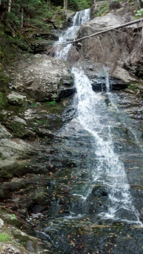
Moosilauke doesn’t play around. Going southbound, you start climbing almost immediately, and the trail literally climbs the edge of the waterfalls, perhaps somewhat like the Panther Creek Falls Trail in North Georgia, only steeper and more popular.

image

Continue reading

Green Apples of the Sun

It’s fitting that the Vermont border is at the top of a hill. It was only 2.5 miles from camp to Vermont, but it seemed like more, partly because of the excitement of entering a new, higher state, widely held to be one of the most beautiful on the trail, but also partly because halfway up, I found someone I hadn’t seen in about 3 months…going south. If you knew him, or remember things I wrote half a year ago, you’d realize who I must be speaking of instantly, but since it’s unreasonable to expect that of anyone who wasn’t there, I’ll remind you.
Continue reading

Kent, Zombies, Beards, Parasites

I woke up the next morning in my hammock. I left it set up, and emptied my backpack into it. I put Copper on the floor inside the shelter (one of the earliest lean-to-style shelters I saw, complete with deacon seat separated from the sleeping shelf by a gap to trap porcupines–Copper had come in limping the night before so I figured he’d be happier sleeping in all day and recovering), and walked my empty pack into Kent. Continue reading

Expectations Annihilated

Sorry this post was so long in coming. I’ve actually been in Pearisburg for almost 29 hours now, as I was informed upon reaching cell service land that my website was down. Well, it took most of a zero day and three support tickets to get it working again, but I think everything is back to normal now. “Now” is the middle of the night, and it looks like I’m going to have a very late one getting this written and an early morning washing clothes and a dog tomorrow.

When I uploaded the last post, I was sitting at The Barn in Atkins, finishing my lunch. I left there and moved quick trying to make it fifteen miles before the rain. It was pretty warm out, but we stopped only long enough to get a picture of this privy and torn-down shelter marking the approximate spot 1/4 of the way from Springer to Katahdin.
image

Continue reading

Humpin’ A Greasy Knob

The weather and the trail coming away from the Nolichucky and Erwin were both nice, if cold. What with how nice it was, I was surprised to see Pilgrim marching back south saying “I’ve been praying all morning, and I’m ending my hike here. God is telling me my true purpose is providing to trail magic to the other hikers.” I never met him before, but it’s always sad to hear a thru-hiker is quitting.

It was only around 5 miles to the first shelter, and we had no intention of staying there, but the sky opened up and a nice day turned rainy as we climbed the last stretch to it. A large group was there waiting out the rain and eating lunch, including a guy who was crazy enough to be carrying 60 lbs. up the trail, a third his body weight! But the only one who stuck around when it stopped was Crow, a Hawaiian guy who was “taking the day off” by only walking to the first shelter and spending the night there. One interesting thing about this shelter was a hiking challenge inscribed on it with several rules, but the gist being that two hikers sharing a pack must leave no earlier than 5pm from the shelter to go to Rocky’s pizza in Erwin, order 2 large pizzas upon arriving, and bring them and a 12-pack of beer back to the shelter before dark. Clearly a challenge for summertime.

Continue reading

Snowblazin’

Clay, who, with his wife Karla, played spades with me and Katfish my last night at Hemlock Hollow, taught me how to make panoramic pictures with my phone that night, so this post will be full of them. Hope they fit on your screens.

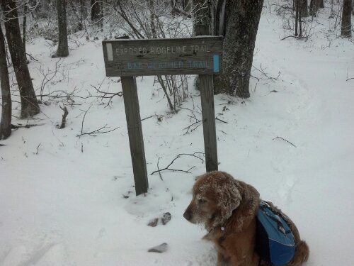
I woke up early that next morning and got my coffee and breakfast, settled up, and packed. Around 9:30, I got a free ride to the trailhead. It hadn’t been snowing too long, as there was only around an inch on the ground. For the first couple of miles, the only footprints were those made by me and Copper until we were passed by Zippy and Ditto, who had spent the night at the last shelter before the gap. I caught up to them at Little Laurel Shelter and we chatted over lunch. I told them I’d be pushing on to Jerry Cabin Shelter that night, and they made noises about doing the same. We also discussed the upcoming decision of whether to take the trail along the exposed ridge the AT follows over Fireskald Mountain, or to take the Bad Weather bypass trail because of the snowstorm. I knew I would be staying off that ridge, but apparently I was the only one who avoided it, because I was snowblazing the bad weather trail (or Packgrabber Trail, as it should be called because of all the low-hanging laurels I had to duckwalk under) when I got to it.

image

Continue reading