A nasty bout of weather cut short my one-week-to-Pinkham-Notch plan after a mere 5 days. Six days after being shuttled from Chet’s out to Kinsman Notch, I was back again. And I wasn’t the only one. Icarus was back again, having spent the past few days hiking the Pemi with Damselfly and Splash. He showed me pictures they took cavorting on the edge of Bondcliff and enjoined me to go see it myself, extolling it as the most beautiful spot in the Whites, and judging from the pictures, it seemed likely he wasn’t exaggerating.
An epic battle for Bondcliff (by Rachel “Damselfly” Kirchoefner, with Chris Eli “Icarus” Polett and Josh “Splash” Isbell)
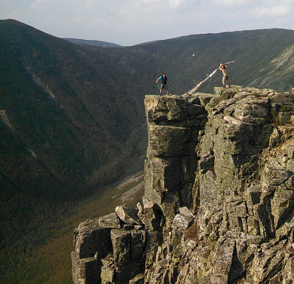
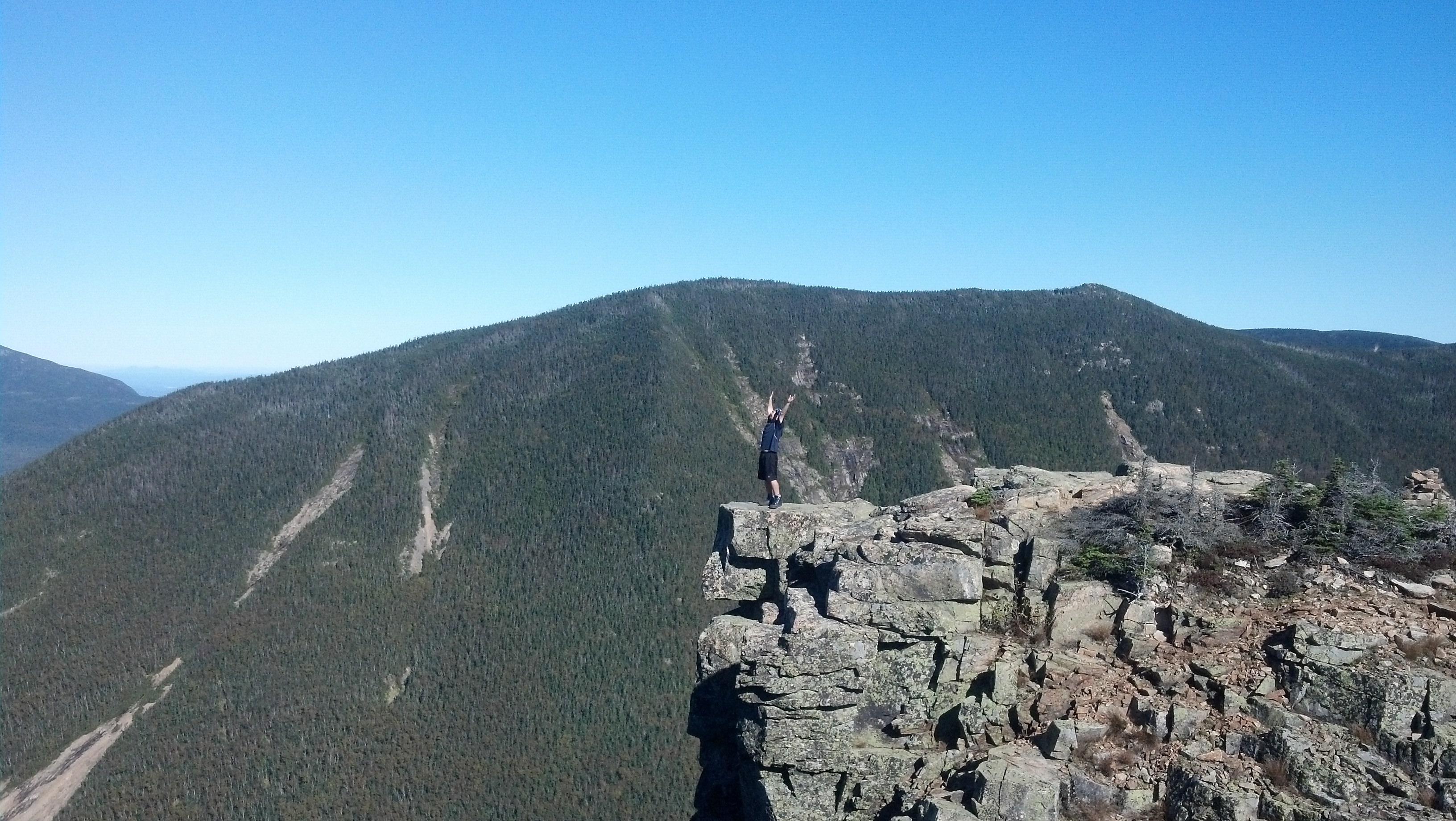
A timed selfie on Bondcliff by (left to right) Icarus, Damselfy and Splash
Yes, Icarus was there, and since I’d last been there, he’d decorated the entire back porch of Chet’s with glue on plastic gemstones. Apparently when he ran out of cleaning chores to do, he took up an artistic prettification project.
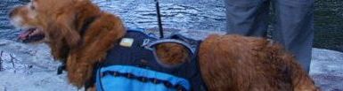
I left my pack on one of the mattresses in the garage to claim it for myself and Copper, and headed off to get my shower and get my wet clothes into the washer.
When I was somewhat decent, I headed back to meet the new folks. Miller and Pound Puppy were hanging out on the back porch and somehow, I’d not seen them before, though they’d been all around me. Most of the people who would end up staying there that night hadn’t arrived yet.
I had a few things I wanted to get done while I was in town, one of which was put more audiobooks on my music player. On my previous visit to Lincoln, I’d managed to accomplish this in the Lincoln public library, but this time it was Saturday and the library was closed. I biked over toward the Price Chopper, next to which stood a strange little store, packed with books, movies, software, rentable computers, and a coffee bar, all being run by one guy. It was a mess, and I’ve never seen anything like it. But I was able to get on the internet for a half hour and download some new tracks, and he undercharged me for my time in the end, so that was a plus (and actually, made the computer use prices reasonable rather than exorbitant).
While I was there, a guy came in to get some menus printed, because apparently it was the one place in town you could get things printed in large enough amounts. He showed me the menus, which were for the “Landmark Diner” in North Woodstock, a Greek restaurant. He encouraged me to come there for dinner, so I decided to take him up on it. After all, having been within a few miles of it once before already without having visited, it was about time I checked out North Woodstock. When I’d finished at the coffee shop, I took the bike under the interstate and down North Woodstock’s main drag. The Landmark was easy to find, and they had an interesting selection. I decided to get a gravy-soaked mutton dish that came with a salad. Both were terrible. But their savory baklava was quite good. Didn’t make up for the rest of it, but hey, they can’t all be winners.
After I’d eaten my fill, I took the bike back to the hostel a different way. When I arrived a whole batch of new people had arrived, including one I never expected to see again. I last left G-Baby back in Erwin, TN in Ponch’s cabin (in Ponch’s bed) at Uncle Johnny’s. She remembered Copper, and therefore me, but I had utterly forgotten about her. I knew I recognized her, but she had to reconnect the name with the face for me. (She also explained how the G stood for Genevieve, a name I thought was nice, but she preferred not to go by.) Anyway, she had another hiker in tow this time: Storybook. They set up a tent in the backyard like I had last time, because all the inside spots had been taken.
This crowd was a lot less drunk and a lot more chill than the ones from the last time I’d come. It may have helped that several were much older, early to bed and early to rise, so we all got to sleep at a reasonable hour. I spent the entire first hour of light’s out online, trying to get a tiny bit of blogging done, but I was mentally worn out and couldn’t focus. Somewhere around four in the morning, I woke with terrible cramps in my gut, and barely made it to the bathroom before my supper came pouring out (in the correct direction, fortunately).
I had been planning to reseal my tent rainfly and then get back to the trail, but when this whole fiasco recurred two hours later, then two hours after that, and again, and again. . . well, that plan obviously went right out the window. I have no idea what mad malady overcame me—every communicable disease imaginable has been caught and passed on by an A.T. hiker at some point—but I do know that it was not full-on gastroenteritis. I’ve had that before, and this was positively pleasant by comparison. I mean, at least I was able to replenish my bodily fluids as fast as they were flowing out, and no hospital visit was necessary. In fact, I was able to get quite a bit done in between trips to the bathroom, including biking to Dunkin Donuts for breakfast (to go, of course), spying some of the more touristy sites of Lincoln in the process (there are at least two foliage train rides, including the Hobo Railroad), visiting the outfitter (for some new long underwear), visiting its associated shoe store for a new pair of boots (a pair of Merrell Wilderness Original, which I hoped to break in on the trail and I expected to last forever), resealing my rainfly seams, and getting a wealth of Starburst (the best trail candy ever) from a small candy/video/tobacco store, though several times I was moving quite quickly to get back to home base between these errands. By evening I seemed to be recovered.

Hobo Junction Station, train ride and mini golf center, via aroundustyroads.wordpress.com
Miller was quite eager to see one of the NFL games that night (I think it was the Broncos/Giants game that he was interested in), and expected an old friend to come into town that night, so was looking for a trip to a sports bar, and for others to come with him. None of the others could get it together to get moving, but I was more than eager to do something fun to justify the extra day I hadn’t planned to spend in town. We walked for 30 minutes down one road to get to CJ’s Sports Pub. It was indeed a sports bar, and they had both food and beer. I ordered a buffalo chicken mac and cheese, which was listed as a special. Or maybe that’s what Miller got. Either way we got charged a lot more than what we anticipated in the end, plus Miller spent so much time on the phone trying to get his friend to come that he ended up missing much of the game. The friend, on the other hand, had gone to some birthday party and wasn’t coming. Looks like the friend had the best of the deal.
Having put a decent buzz on, Miller decided there was no way we were walking the mile back down the road to the hostel. I thought we’d have to because it was dark as dark could be out and none of the drivers would be able to see us, plus the road we were on was a back road running parallel to the main drag with very little traffic. But Miller did something I’ve never seen done before: he stopped the one pickup truck coming down that road that night just by yelling at it. And man does he have a set of pipes. The pair of guys inside were coming back from a day spent dirtbiking, and knew exactly where Chet’s was. We hopped in the back with a mudcaked dirtbike and got back to the hostel less than five minutes after leaving the bar. As we were leaving the bar, the entire gang of people we were trying to get to go with us were arriving at it. They just weren’t as hungry as we were, I guess.
I think we figured we had no hope of getting to sleep at a result hour that night, since all of those folks were likely to come back late and tipsy. Yet, though folks were, in fact, up quite late that night, they were fairly quiet. Again, I think, the influence of the older crowd with earlier bed times. There was also the influence of Chet, who, as usual, moved into his hostel-level wheelchair and came out to watch over the hikers, answer their questions, and absorb their enthusiasm.
I took advantage of this opportunity to ask if Copper could stay with him for a week while I finished up the Whites. Luckily for Copper, he agreed, and said that Copper could stay in the main house with the other dogs. Satisfied, and with the gathering winding down, I went to bed and internetted myself to sleep.
The next morning I went out on the bike again to get my last town meal from McDonald’s. The weather looked wonderful, my digestive system was much improved, and I was eager to get back on the trail and make up for lost time. I was confident that I would be able to move more quickly without Copper. When I got back from breakfast, I finished packing, then showed Copper into the house. I gave Chet all the food and treats I had left as well as Copper’s medication. I pointed out my number on Copper’s tag if he needed to reach me. Satisfied that Copper would be well-cared-for, I grabbed my bag, walked down to a nearby road, and flagged down a ride going my way almost immediately.
The truck driver was a carpenter or contractor of some sort going back to his home somewhere north of the Whites, and was willing to drop me at the entrance to the Gale River Loop Road. On the way out, I listened to him complain about the job market and political climate, which ended up adding a surprising bit of local flavor to the trip. He said he used to hitchhike himself out of necessity, but wasn’t really in the habit of picking up hikers. In fact, it seemed that all of the rides I got north of Vermont were one-offs for the drivers (but for one notable exception).
So he left me alone at the end of the dirt road back into the Pemi. As I started walking, I passed a gaggle of old men chopping down trees just off the road, which struck me as unusual, considering that’s supposed to be heavily regulated in a national forest. (I found out later that there was a small privately owned holding adjacent to the national forest here.)
A mile down the road, I found the parking lot I’d arrived in two days before and started heading back up the trail to the top of Mt. Garfield, five miles uphill. To my wonder, there was a night-and-day difference in the trail conditions. I didn’t have to put forth any effort whatsoever in the stream crossings. The water was about a foot lower than it had been, there was no water in the trail, and the stream crossings hardly even qualified as such. I was back at the Garfield Ridge Shelter well before dark, but had no intentions of going any further.
The shelter was full of paying customers that night as well, and they were all nice folks, but I don’t remember their names or faces, and only vaguely remember our conversations. There were a couple of old guys who were just out doing a short trip, one of whom seemed full of complaints. There was a Floridian college chick and the guy she was travelling with, whom I’d met at Chet’s a couple of nights previously when she came in with a handful of corn-on-the-cob that someone had given her, which she just distributed to the other hikers. (It was delicious.) They decided to hike down and stealth camp in a known site just outside the exclusion zone. There was a group of four thrus who were all, for the moment, hiking together. One of them had a copy of the list of stealth campsites on her phone, and I had her email it to me since I’d lost my paper copy (but the file ended up being unopenable). All four of them ended up paying and staying with me. Yes, I paid eight dollars cash to stay in a shelter. It was the only time I ever did it, but it was a very nice shelter and I didn’t feel like camping out that night. I made supper and then spent some time sewing up the belt on my pants before turning in before dark.
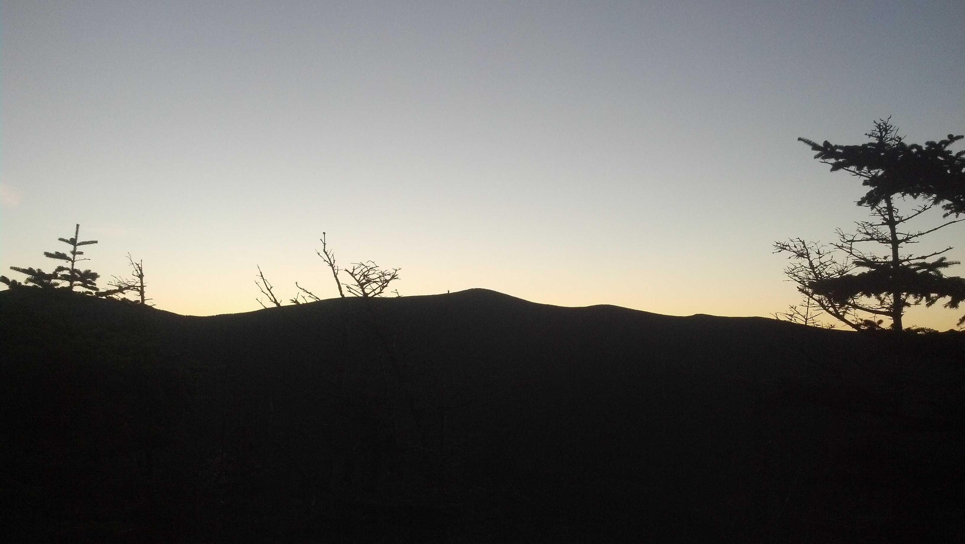
Having made it to bed so early, in the morning I woke up before the dawn, bundled up as much as possible, and rushed out to the overlook to watch the sunrise.
 https://www.youtube.com/watch?v=TMgpXX9VCOw
An hour or so later, I was on my way straight down the side of Mt. Garfield (finally, four days after first arriving on it) and out into the Pemi. Just outside the exclusion zone, I noticed the two hikers who’d stealthed there had not even started packing their tents yeah. I passed them by without much fanfare.
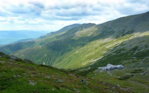
An easy walk below 4000 feet passed, and within an hour, I had arrived at the Galehead Hut. There was some leftover breakfast, cold oatmeal and quiche, that they were giving away for free, so I bought a cup of coffee and had brunch. I filled up my water bag from their sink, and spent a little more time reading this shelter’s copy of “Backwoods Ethics”. Huts also keep the original copies of their guestbooks on hand stretching back for haIf a century. Another guy there had pulled down one that contained a note written by his dad from when he’d been brought there as a kid in the 1970’s.
When I felt guity enough about sitting still, I loaded up and returned to the trail, and was immediately climbing straight up the side of South Twin, and arrived quite quickly back above treeline again. Here, for the first time, I spotted one of the flags planted each September 11th on each of the “official” 4000-foot peaks.
This video was originally pretty long, but there was an error saving it, and everything after the point where you see it stops got corrupted. I made another one with the same information the next day.
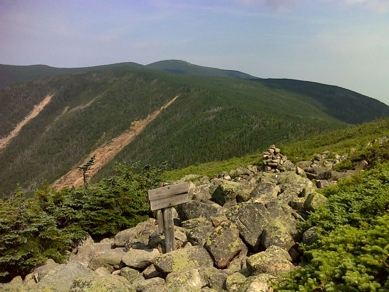
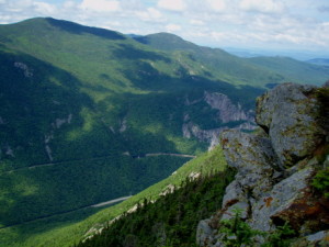
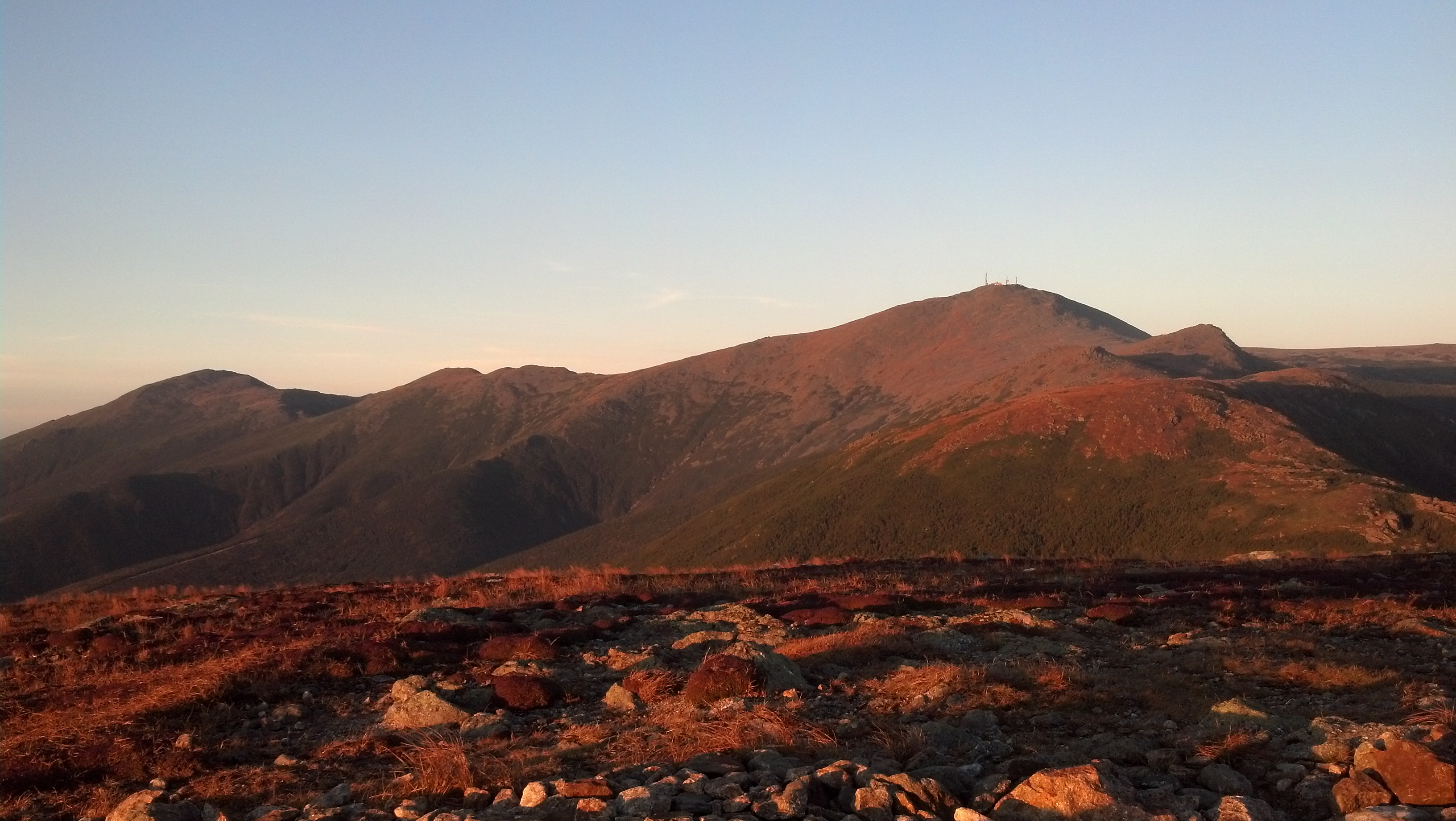
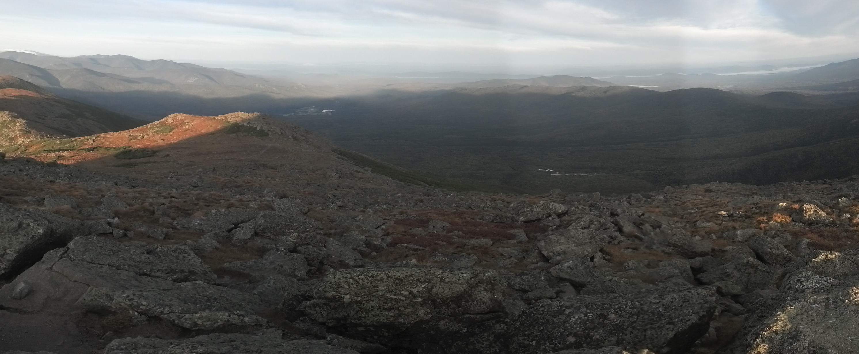
Behind Twin Mountain, the trail does not drop back down into the valley, but instead runs along the side of ridge over piles of small rocks, reminding me of the terrain in northern PA, before suddenly turning left and heading straight over the top of the ridge. Because the weather was so gorgeous, I didn’t turn left here, and instead headed one mile off-trail and then down to the Guyot Shelter campsite, with the intent of visiting Bondcliff.
A.T. @ Mt. Guyot via P.J. Wetzel
I soon had my stuff scattered over the platform inside the shelter (which was tilted downhill about 5 degrees). The bunk was high enough off the ground, one of the handmade wooden chairs that occupied the shelter was helpful to climb up onto it. The shelter had clearly not been fully overhauled in some 30 years, though I suspect it’s been on the AMC wishlist for some time.

Guyot Shelter via P.J. Wetzel
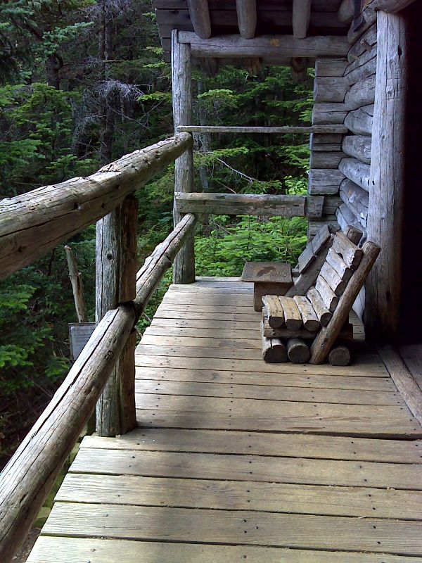
Porch of Guyot Shelter with handmade chairs via P.J. Wetzel
I realized that there was no way I could get out to Bondcliff and back by sundown, so I listened to some Dresden Files and prepared lunch while staring out the open side of the shelter at the view and the activity in the camp. Soon, Miller and Pound Puppy showed up, having started from Franconia Notch when I went back to Garfield and then spent the previous night at Greenleaf Hut. There was still an hour of daylight left and they’d already pulled a 12 mile day over some of the toughest terrain in the Whites. If this doesn’t sound like a good pace, you are underestimating the Whites.
Soon, the caretaker noticed their arrival and came around to collect payment. He said he could take two of us on as work-for-stays, but when I volunteered, he said the work-for-stay was only for thru-hikers. I took this as a compliment, and eventually convinced him by way of getting certification from Miller (whose epic beard bespoke his authenticity). Pound Puppy decided to pay and Miller and I were lead down the garden path to the privy.
There were two jobs to be done there. Mine was to fish through the decomposed waste and remove anything nondegradable. The caretaker had some interesting stories about the kinds of things found in privies, including one time a full unopened can of beer. 99% of what I found was tampons. Apparently, most lady hikers don’t believe the signs on the privy wall that say tampons do not degrade well. Pack it out, ladies! Miller’s job was a bit more physical. He was tasked with “flipping” a pile of 20 pound mulch bags, moving the bags on the top to the bottom and vice versa. Being a more straightforward task, he was finished five minutes before I was.
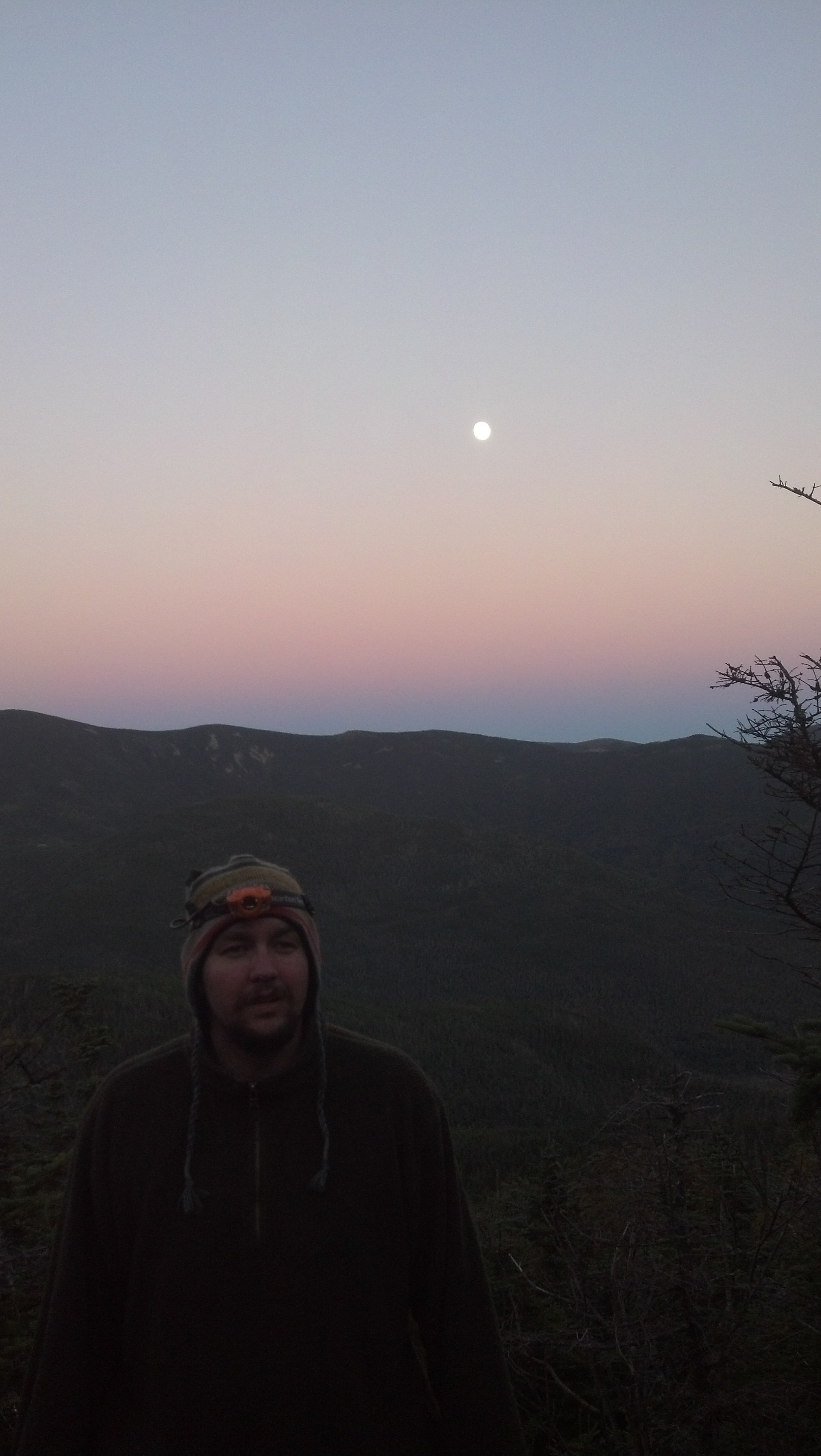
Sunset was starting when we returned to the shelter. The view from the balcony was incredible that evening, because the moon was huge and bright, but all the gorgeous pictures I took of it got corrupted later. Oh well. Here’s one from that night that did survive, which I took standing on the railing of the shelter balcony:
Miller and Pound Puppy had brought out a bottle of Jack, so we swapped liquors (I still had some airplane bottles) and told stories. We even shared with the caretaker who came up to hang out with us for a while.
After dark, Miller took to using the Jack Daniels bottle as a lantern (a lantern-o’-Jack), watching the distorted yellow-tinted light ripple across the ceiling as the bottle was turned one way or another. Eventually, we found a way to be comfortable on the tilting platform (even if it meant putting our heads close to the wall and in the rodent line-of-fire) and got to sleep. It was one of those nights where the moon is so bright, you wake up several times in the night thinking it’s dawn. Eventually, it was dawn, and the east-facing shelter door framed the sun’s rise over the distant mountain ridge. The light shining directly on my face woke me up in time to watch. I woke Miller up to see it, and we watched it without ever leaving our bags.
Dawn from Guyot Shelter
I didn’t bother to completely pack up yet. I just put together some snacks and water in the detachable slackpack, and ran out to Bondcliff as quickly as I could.
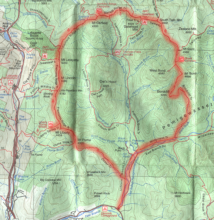
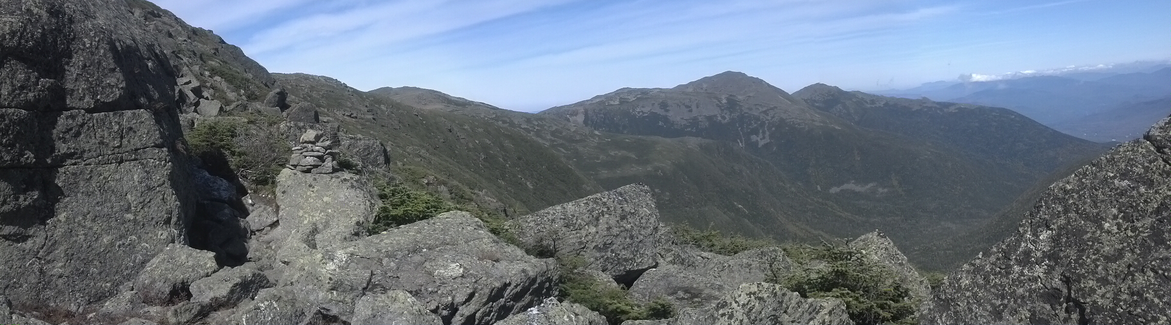
The Pemi Loop
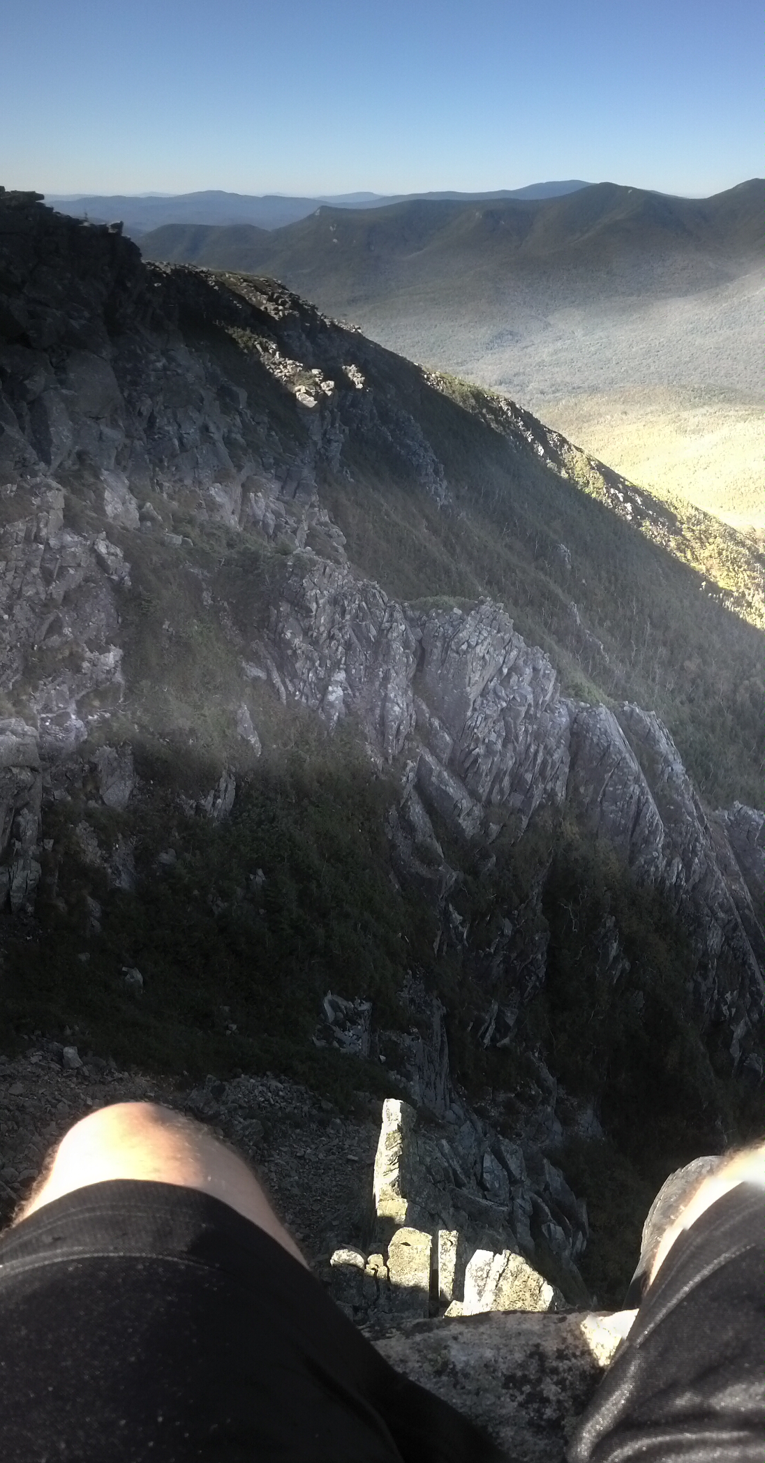
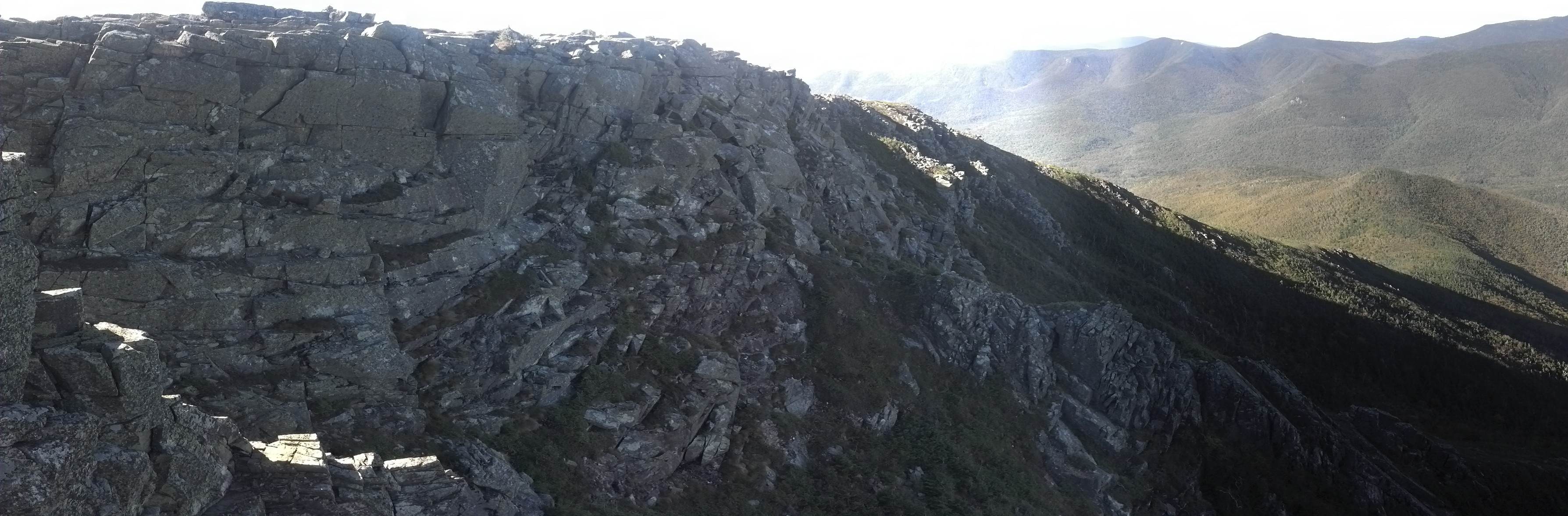
I couldn’t have asked for a more perfect day. And though I was not the only one around, there were not that many others around. I descended from Mt. Bond to Bondcliff with a man who had started the Pemi Loop a couple of days before, but gotten so sick and sore that he was headed right back out the same way he’d come in. There was another couple there on Bondcliff who came up there from the other direction. I sat down and ate some snacks (and shared some with the sick dude) waiting for my opportunity to get my picture on the iconic rock above the cliff. While waiting for my opportunity, I reshot the video that I tried to make on Twin Mountain (though, as you’ll see, I confused Owl’s Head for Twin).
Then I took what photos I could from the same rock Icarus and Splash had “fought” upon.
I managed to convince the guy who was there with his wife to take my picture on the rock. I handed him my phone and he took it up to the summit to take the picture. Because of the glare, he ended up pressing the button to use the front camera.
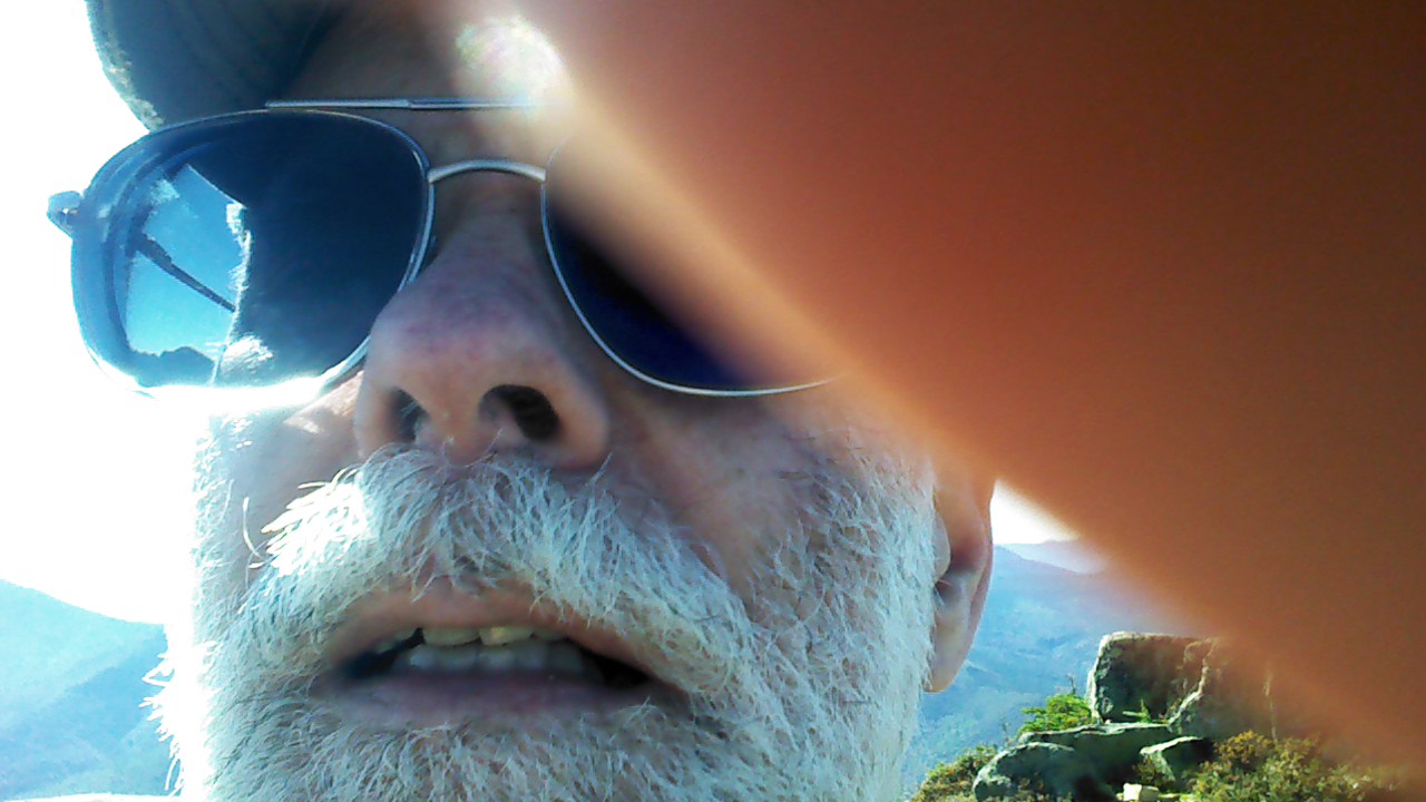
The guy who took my picture
Unsure of whether he’d succeeded, he brought the phone back to me to find out for sure how and whether it worked. He somehow started a video recording before he walked back to me.
But he did manage to get it on the second try…
After they took off down the trail, another guy showed up. A peakbagger and a vet, he was out trying to hit as many of the four-thousanders while the weather was nice (and boy, it could not have been nicer!). I remember he carried a surprisingly large machete in a leather holster, which he said had been a gift from his father or father-in-law. We started climbing Bondcliff together, but I beat him by five minutes. Proof that my months of hiking had truly improved my condition. I went on back to the shelter to pack up, and he headed out to West Bond.
Back at the shelter, two park rangers and an AMC boss had joined the caretaker for lunch and to discuss some improvements to the site, including the drawing and printing of a new map. After I had eaten lunch, packed, and was ready to hit the trail again, I accosted them to ask about the tree cutting on the Gale River Loop Road, and that’s where I found out about the private holding there. They thanked me for letting them know, and I proceeded to hike the mile back to the A.T. Somewhere on that section, my profile map fell out of my pocket. I didn’t bother going back to look for it, as I was going to reach the edge of that map’s territory that very night anyway.
Back at the A.T. junction on Mt. Guyot, I saw a pack had been left there, with no owner to be seen. I found the owner just a bit up the trail. It was the same guy I’d hiked up Bond with, and he’d just been doing a quick slackpack to bag Zeacliff before heading off to finish the Pemi Loop. Since he’d done it, I turned off on the Zeacliff Ridge Summit Trail when I reached it as well. It was a like going back to Vermont or even Virginia again: above 4000 feet, but completely surrounded by trees, with not a view to be found.
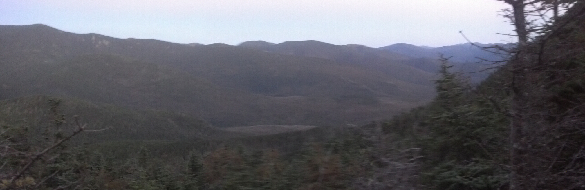
Back on the trail, I started a slow descent into the valley. I say slow descent, but really, it barely descended at all for the first two miles. It was mostly open and rocky, or sandy, or muddy, with lots of bog bridges. Somewhere around the side trail to Zealand Pond, another hiker who’d come up the Zeacliff Trail had told I had to step off trail for a bit at the next fork to check out the view from the top of Zeacliff. The views had been gorgeous all day, so I decided it would be worth it. It was. I could see all the way to the Presidential range and beyond. It’s a pity the pictures I took of it corrupted so badly Explorer crashed trying to preview them. Here’s someone else’s picture of a similar view:
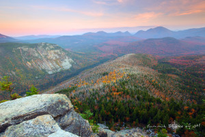
via summitphotographynh.com
From there it started dropping at a much quicker rate until before I knew it I was at Zealand Falls and the adjacent Hut. The trail goes right across the creek that is Zealand Falls, a solid, smooth slab of stone. I took a video of it that gave a complete view upstream and down, but of course the entire downstream part of the video got corrupted, and what was left is below. (I think this is proof of the argument that technology has become a replacement for human memory. As cheap as it is now, they are doing quite a good job of replicating even the fallibility of human memory by letting our devices forget and garble memories just as often as we do.)
Of course I went inside the hut to check it out. It was late afternoon. Not supper time yet, but the guests were starting to trickle back in. I located the hut’s copy of Backwoods Ethics and sat down to snack a bit and read, while passively listening in to the guests’ conversations. An hour or so before sunset, I packed up and headed out, wading through a mob of schoolchildren returning from a day hike on my way back down to the creek and across to the trail.
The A.T. joined the Ethan Pond Trail here, which is an old railroad bed. Aside from right near the beginning, where it winds around and over some boulders and gravel which accrued due to landslides since the rails were removed, it was perfect flat and level for five straight miles. Even when there were roots and mud in the trail further down, I was flying the whole way. As a result of setting out at such a late hour to make it to Crawford Notch, I couldn’t take the side trail to Thoreau Falls—it would have been too dark to see anything worthwhile by the time I made it there anyway, so it wasn’t worth the mile total side trip.
Just after dark, I wended my way down the shelter access trail skirting the edge of Ethan Pond. There was one guy set up sleeping in the shelter, but he spoke to me as I walked up. I wondered if he’d mind my sitting in the shelter long enough to eat supper, but he just said there was food preparation area down the trail beside the shelter. I took that as an “I just want to be left alone to go to sleep,” and went to the specified area.
While I cooked and ate, a camper came up wondering where the bear box might be, and I made some suggestions, but it ended up being hidden better than either of us expected, and he had to accost the guy in the shelter to find out what tree they’d hidden it under.
I finished up, cleaned up, packed up, tossed my pack back on and headed out to the trail again. I finished the last two and a half miles to Crawford Notch under headlamp light, but in high spirits, tuning into a pop radio station for energy. I barreled down the trail singing Cee-Lo Green’s “Forget You” at the top of my lungs (though of course, I corrected the radio edit back to the original as I sang). The last mile descended slowly but steadily down muddy hills strewn with pebbles into Crawford Notch State Park, and suddenly I saw a sign spelling out the rules for visitors to the park, and just beyond it, the road, painted by the headlights of a late-passing semi truck.
I crossed the highway and followed the trail as far as the Saco River Bridge, where I found a cleared gravel-strewn lot easily big enough to set up my tent. It was probably past midnight at that point, and I didn’t want to go stealthing somewhere I’d be crushing plants and making an eyesore of a landing zone where once was wilderness, so I was willing to set up within headlight-and-engine-noise distance of the road. It was my base camp for the next day’s assault on the Presidential Range. Thus concluded a 15 mile day: the biggest miles I ever managed in the Whites.
I heard several hikers pass me before I got up the next morning, around a half-hour after sunrise. Of course, there was no privy around, so I did have to go dig a hole in the middle of the little strip of forest separating the river from the road, which meant that I was visible from the road if the drivers had stopped to look through the trees—but why would they?
I found a way to get down under the bridge and get some water from the river, because I knew I’d need quite a bit for the climb ahead. I was thankful not to have Copper with me for the moment, because I was planning to do half the Presidential range in a day, including the steep climb up Webster Cliffs, which are like the Superfund trail out of Palmerton, but going up for 500-1000 additional feet. I was eager to get started, because the weather was still wonderful and I heard the cliffs afforded amazing views.
Just as I started winding my way along the Saco River Trail to the Webster Cliffs Trail, a trio of hikers came up behind me. Two were thru-hikers, a boy and a girl, apparently a couple, who’d already made it this far together. I wish I could remember their trail names, because they appear in this story more than once. The third was his dad, who was finishing up a section with them here.
They were moving quickly up the hillside and promptly passed me. Not to be so easily outdone, I stayed right on their tail as they worked their way around the many switchbacks and up the ledges that start the Webster Cliffs Trail. However, the dad soon began to complain of some issue which he had to stop to take care of. So I passed them, and got a good lead, yet they caught up to me by the time I reached the exposed rock-climbing section of the trail.
The trail starting worked its way up the edge of the ridge, staying near the edge of the cliff face, occasionally diving into the spruce to go up an easily climbable ledge. Every 500 feet of elevation gain, it would emerge onto a smooth flat rock, with a clear 180 degree panorama, then go straight upward to the top of the rock and onto the edge of the ridge again. Eventually, it started climbing up piles of rubble and crumbled dirt, where trekking poles became more of a hindrance than an aid. Hands were absolutely necessary to continue.
But, oh, the views. I stopped several times here to get a good look at where I’d come from, and the bluffs lining the other side of the notch, including the visitor’s center below it and the train route carved into the side of it. Once, all four of us climbers stopped to watch the train go by. You’d think I would have had the sense to take a picture. Fortunately, someone else did:
By Jason Morris
The other three climbers passed me as I sat down on that rock to snack and watch the view. When I packed up and headed back into the trees, I found them all sitting on a rock at the top of the next hill. I stopped to chat about the weather and things, and admire the pears they were eating. The dad was nice enough to give me an orange he’d carried up to see off the kids. Super generous. It made my day. But I had a long way to go, so I waved goodbye and marched on uphill (though not so steep) to arrive at Mizpah Hut. I remember passing quite a number of people that day, including a huge crowd of day hikers on the very ledge the above picture was taken from. The A.T. here coincides with the Crawford Path, the original path forged by Abel Crawford, the earliest settler of Crawford Notch, when he would lead guests on hikes to the top of Mt. Washington, and his path is still relatively as popular today as it was then, especially when the weather is as clear as it was for us that day.
I stopped for a long time at Mizpah Hut. It was around 4pm when I was there, because I recall one older hiker (whose trail name I again don’t recall, so let’s refer to him as Ghost for the purposes of this story). He’d just come up Webster Cliffs himself, and was ready to quit, so secured himself a work-for-stay at the Hut. I stayed long enough to eat lunch (I bought some of their soup) and read another chapter or so of Backwoods Ethics. It was just before sunset when I headed out again to make it the ? miles to Lakes of the Clouds Hut.
Just above the hut, a pair of men were settingg up a tent on a rock at the top of Mt. Pierce (now called also Mt. Clinton, most likely due to Pierce being rated the fourth worst president of all time, while Clinton is tied for a place securely in the middle of the pack.) Sleeping out anywhere above treeline is not only illegal, but highly unethical, as it stands a good chance of crushing delicate alpine vegetation which is evolved to withstand harsh weather conditions but not being trod upon. Worse, it could establish a trend if the vegetation is killed, leading to an established stealth site taking decades to recover from a couple of year’s worth of use, at great public expense to protect it. Of course, being rather leery of starting a 2-against-1 confrontation and also in somewhat of a hurry, I hiked on without a word.
Soon, I was above treeline proper, which meant the day would last a few minutes longer, but it was still going faster than I was, and there was no way I could outrun the sun. Especially since my goal was to hit the summit of every major peak of the Presidential Range. You might think this is just crazy, if you are or know any thru-hikers. Why would any thru-hiker go a thousand vertical feet and a half-mile off trail? I guess with all those summits being easily visible and accessible, and the prospect of not being back in the Whites for years, I became a peakbagger while I was there. Or maybe I was just disappointed the trail didn’t go over those peaks by default. As they say, if you’re not climbing over the tops of mountains, you’re not hiking the A.T.
Anyway, just before sunset, I turned aside to go conquer the summit of Mt. Eisenhower. The trail kinda winds around one side of it, switching back a few times, then BAM, you’re suddenly at the rock cairn at the summit. With the sun going and no protection from the wind, it was incredibly chilly out. I had my fleece on, but I had to put my packa on over it, and then sit down on the leeward side of the cairn to maintain temperature long enough to get a fair few shots. Despite it being a beautiful day and a clear evening, I could see how it was that so many folks died up there. Hypothermia alone seems like it would catch a fair number of unprepared hikers, even without taking the weather into account.
![]()

When I couldn’t bear sitting still in that cold wind anymore, I put my phone back in its case (careful not to let the case blow away) and the case back in my pocket, then started tramping down the other side of the peak. Immediately I met another hiker rushing to the top, having hiked out of Lakes of the Clouds southbound. I talked to him for about a minute, but he was eager to get to the top so as not to miss the sunset, which was almost over, so I let him go. The switchbacks resumed until I was back down to where the little peak rejoined the level of the ridgeline, and a sign directed me between the rocks lining the trail and back up toward the Crawford Path.
Notice the face-shaped prominence on the side of the peak right at the bright horizon line.
Back up on the trail, I made a beeline for Lakes of the Clouds, moving quickly to keep my temperature up in the punishing chill wind. In my headlong rush, I missed turning aside for the Mt. Franklin summit, but I didn’t care. It was late and I wanted food. I was starving, and Lakes of the Clouds let work-for-stay hikers eat the leftovers from the guests’ supper.
But I was cold and starving, and the miles kept dragging on. It’s only two trail miles from where the Eisenhower sidetrail rejoins the Crawford Path/AT to Lake of the Clouds, but with the wind and the hunger, it feels like a lot more. Somewhere below Mt. Monroe, I caved. I stopped and cooked some hot food in a crevice beside the trail with some modicum of wind protection, and was warmed by the hot water entering my body, even as sitting still for the ten minutes it took to cook it left me colder than I had been hiking. With a few extra calories for the final push, I worked my way around Monroe, stopping briefly to check out a sign designating a protection zone for the endangered Robbins’ cinquefoil flower, found only in the alpine zone of the Presidentials. It was like a gift when I finally crested a hill and spotted the floating squares of light in the Hut windows below me in the distance. I hurried down to it and walked inside out of the cold.
Finally, after a solid 12 hour, 12 mile, 3900 vertical foot day, I was able to take off my boots. And this was an awfully good thing to do, since my new Merrells were finally starting to break in, and they were breaking in wrong. The left boot was buckling in the toe box in such a way that it was pinning down my pinky toe with every step, mashing it into the insole. I changed into my camp shoes first thing.
Inside the hut was a madhouse, with all the guests in the main room eating dinner, or standing up buying things at the store. All the hut kids had their hands full. I dropped my pack by the door and tried to look like I belonged until someone came free to talk to me. Eventually, I decided to just walk into the kitchen and accost someone. After confirming that I was a newly-arrived thru-hiker, they directed me to the sink in back where several others (including the two I’d met on Webster Cliffs earlier) were already elbows deep in soap and scrub brushes, trying to unblacken the pots and pans in preparation for the Hut’s closing for the season in two days time. I joined in, and spent the next half-hour scrubbing one pan with all the finesse, raw effort, and chemicals available only to leave it ever so slightly less black than it had started. They clearly had a herculean task ahead of them if they planned to get all these shiny before the hut closed.
Soon, the “croo” had finished dealing with the guests, and signalled this fact by removing their aprons with a unanimous shout of “HUT KIDS! Gotta catch ’em all!” Then they brought the leftovers back to the kitchen and arrayed them on the counter and said “Dig in.” The head manager of the croo even brought out a jar of apple white lightning and let us all sample some. Well, more than that, actually. We were required to kneel with our heads tilted as far back as they could go while he, standing behind us, poured it in a stream from high above. I wish I could remember his moniker, because in an hour he reversed all the bad first impressions that girl at Lonesome Lake had made with respect to Huts’ treatment of thru-hikers.
With all the guests in their bunks, we thru-hikers had the run of the dining area, so I threw my sleeping mat down on the floor (away from a puddle of spilled water and away from the cold-to-the-touch windows that were rattling from the gusting wind outside), grabbed one of the hut’s copies of Backwoods Ethics and finished reading it before I fell asleep.
In the morning, I woke up at dawn, just before the hut kids came out to start making coffee. I packed up all my stuff and restored the table to its usual state as quickly as possible in order to make room for the paying guests to convene for breakfast. I told the hut kids I’d work for breakfast too, put on a coat, put my phone in my pocket, and headed out to bag Mt. Madison while the guests were eating. Once I got over the initial shock of cold, it only took twenty minutes to get to the top: it’s literally adjacent to the hut, and the summit is maybe 500 feet up. The sun was still low on the horizon when I reached the top.
Morning on Mt. Madison
When I got back to the hut, guests were in the middle of breakfast, so I grabbed a copy of Backwoods Ethics’ sequel Wilderness Ethics and sat on a bench reading until the finished. Eventually a hut kid called me into the kitchen to feast on the leftovers of breakfast, after consuming which I was appointed the arduous task of sweeping the dining room. I was done in ten minutes. At this point, it was almost 9am and I needed to get going if I wanted to reach Osgood Tentsite by nightfall, bagging all the peaks along the way and still squeeze in a lunch feast at the Mt. Washington summit. The head croo guy I liked so much told me I should go check out the remnants of the original Crawford Path before I headed up, as there were still some metal struts coming out of the ground which held down the shelter that used to give those climbing the mountain a night’s stay before the huts were built and the path diverted to bring hikers to the doorstep of Lakes of the Clouds.
Lakes of the Clouds Hut via 1happyhiker.blogspot.com
So I did. I dropped my pack at the place behind the titular lakes where the paths diverged, and headed up to the center of the ridge to check it out. It was about a quarter mile up, and I passed it at first. Realizing I must have gone too far I backtracked a bit and finally spotted the remnants of the cairns that marked the original path. They’ve still not been dispersed even to this day! Rock-hopping off-trail a bit (for leaving the trail above treeline is forgiven when one is careful not to tread upon any sensitive vegetation), I managed to come to the wires emerging from the rock which held the original shelter to the ground in the face of the most brutal winds on the planet. There wasn’t much else to see: all was left to the imagination.
While walking back to my pack, I spotted an oddity: a brightly-colored backpacking tent situated in a grassy area adjacent to the lower lake (the one further from the hut). The sight immediately drew my ire, as it was not only illegal and dangerous to camp above treeline in the Whites, it was doubly unethical to just sleep right on top of some of the most sensitive plants in the country. Not one to pick a fight—and it not really being my place to do so—I returned to the hut to tell someone. The dude whose name I wish I remembered said he’d go out and talk to the guy, assuming he could even be found, but that it was probably just the result ignorance and stupidity, and he could only maintain his blood pressure by assuming that a calm discussion would fix everything. (I am gendering the previous sentence thus in the fondest hope that a woman would be smart enough not to camp above treeline.)
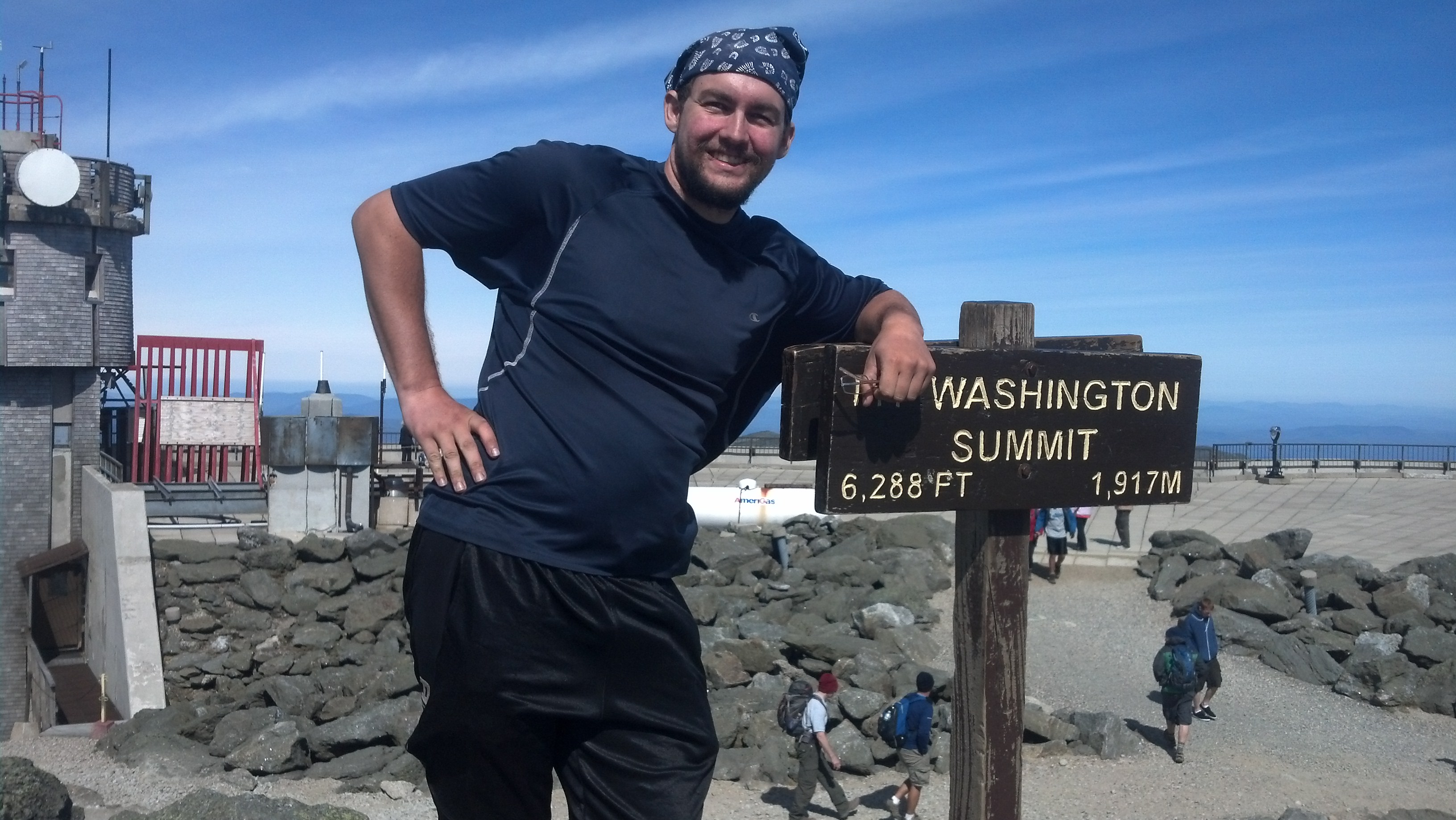
We set out together, but went our separate ways as the fork in the road. I turned up the trail to the top of Mt. Washington. The trail was already swamped with hikers, many coming down to Lakes of the Clouds, possibly to spend the day there or just to have a good time above treeline with no packs on their backs. It took me maybe an hour to climb the 1000 or so feet to the top of the mountain, with the wind getting stronger and colder every five minutes, even in spite of the sun, until finally I was up on the plateau of the peak, where all the buildings and radio towers stand strapped to the rocks. It was my first time above 6000 feet since the beginning of April: Roan High Knob in Tennessee, and the last time I would reach such heights anywhere on the trail.
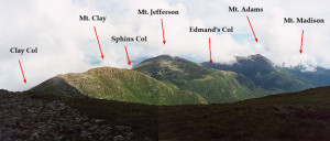
No matter where you are on the Eastern seaboard, if you can get above 6000 feet (which pretty much limits you to five peaks), you are looking down on everything, even other mountains. But the top of Mt. Washington is the strangest of them all: it’s like an alien world which humans have meticulously terraformed. The top is flat and filled in with gravel, surely the result of months of labor. Cars are driving up the road and parking there. A railroad runs right up over the lip, and cog trains come every few minutes carrying tourists to this alien planet in the middle of the wilderness. With its climate, weather, and geologic features, there’s no place quite like it in the world. Even it’s not like itself anymore. I really wished I could have seen it before it was bulldozed and built upon. Spotting Mt. Adams in the distance, the second highest peak in the range, I vowed to summit it to gain the experience that Abel Crawford had on Mt. Washington.
The rest of the Presidential Range, including Mt. Adams (the tallest one) as seen from Mt. Washington
I dropped my pack and spent a few minutes exploring. First, of course, I got in line to get my picture taken at the summit. I figured the line would only get longer, and swapped photos with someone standing next to me in line.
Then, I looked inside the Tip-Top House hotel, restored to its condition as of 1908, and watched the video playing on the wall, showing the weather scientists braving the winter up their, throwing themselves across the snow-covered parking lot like bowling balls during one of the worst blizzards in recent memory. I stood in the yard and tried to figure out how far I could see to the west, but a bank of clouds somewhere over Vermont obstructed my view after a couple of hundred miles. Then, I made sure I had my wallet and headed over to do the one thing I was, at present, thankful had been made possible since Crawford’s day: eat.
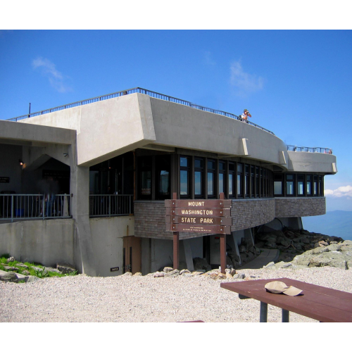
Snack Bar (via nhstateparks.org via Ellen Edersheim)
After pushing my way through a crowd of people all leaning a little bit upwind to stay upright, I found my way into the Mt. Washington State Park’s main building, which houses some hiker organization areas, a small post office, a museum, a weather observatory, all of which I did not visit or use, and more importantly, a bathroom, and a snack bar. Today’s special at the latter: meatball subs. I got that and a hot dog with sauer kraut and several other items that struck my fancy, plus two Cokes, one to pack and carry with me. It was the biggest meal I’d head in a long time, and I had to sit with others in the cafeteria to eat it. I probably looked like a (and ate like) a pig. It certainly didn’t take long to make my way through that feast. I was probably in there for an hour tops, including the bathroom trip.
I asked one of the folks at the information desk where I could try to see Tuckerman’s Ravine. I’d seen a great panorama of it full of skiers in winter on the wall of Lahout’s Ski Shop when I was unwisely buying my boots. Unfortunately, she said, it’s not visible from the summit, as there’s a ridge in the way. Oh well. I’d get to see it later, however. (Four days later to be exact.)
When I emerged, the bank of clouds had gotten considerably closer, so I found my backpack again, hefted it, and set off over a scree* field behind the Tip-Top House toward the railroad and the Great Gulf. The walking got easy once I got away from the tracks (and no, I didn’t moon the cog train. Sorry to disappoint.) and I felt in fine condition to accomplish my goal of summiting every peak in the range on my way out.
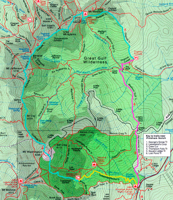
Notice how the peaks are on both sides of the Gulfside Trail. It goes west of Mt. Clay and then east of Jefferson and then west of Adams. The trail marked in blue more closely resembles my path, up until Thunderstorm Junction. (via jenyu.net)
The trail kind of winds back and forth to the “outside” (away from the Gulf) of one peak and then through a gap to the “inside” (alongside the Gulf) of the next. First the Gulfside Trail/AT runs through Clay Col, and then a side trail runs right up to the top of Mt. Clay. There’s little to be said about Clay: it’s more of a hillock compared to the other peaks in the range.
via jenyu.net
In the Sphinx Col I passed a pair of young girls (18 at a guess) who appeared to be out for the first time with their gear. They caught up to me when I stopped at the summit of Jefferson, after I’d wandered around near the summit and was coming back down to march on. They were just reaching the top, so I pointed out how quickly the clouds were gaining on us. At this point, the vanguard of the bank was already tumbling over the summit of Mt. Washington and smothering it in an afternoon fog. A pity for the tourists who were just arriving there, to have missed out on the beautiful views of that morning. (Of course, I missed out on the still warm afternoon at the summit Miller and Pound Puppy had managed on the previous evening while I was still working my way up into the range, or so they told me.) And it was looking like I wasn’t going to get the full experience of Mt. Adams either, as the clouds were likely to reach it before I could.
In fact, they reached me somewhere between Edmands Col and Thunderstorm Junction and they brought their friend rain with them. That, coupled with the occasional 50mph wind gusts that sent me diving towards the rocks to keep from being bowled over quickly soured my mood and made me wish I’d foregone a hot breakfast that morning. I quickly fell into a foul-mouthed mantra in which I repeatedly wondered how much farther the Madison Springs Hut was, cursed every spot in which the trail become crumblier and winced at every step from my badly-breaking boots rubbing my toes raw.
With visibility dropping to the tens of feet as the clouds moved across the trail (and I through the clouds), it became harder to spot the next cairn marking the direction of the trail. I was very glad to spot the enormous heap of rocks at Thunderstorm Junction marking the distance to the Hut. I stumbled upwind, following the trail to the other side of the ridge, wondering if I’d even be able to find the hut. What I found was a double rainbow. Somehow, the position of the late afternoon sun behind the mist had arranged for the visible end of one of these rainbows to land right in my path to the Hut, as if the Hut were a pot of gold. I would have traded a pot of gold to be inside at that particular moment.
A quarter-mile down the talus field**, I could finally stop struggling to keep the boot from buckling on my poor toes, as I arrived at the section of trail contracts had spent countless hours rearranging rocks and boulders to fill in gaps to create a flat, level path sloping easily down toward the hut. The hut was still out of view, but I was thankful that I could move much quicker the rest of the way.
Soon, the hut emerged from the fog like a ghost, and I splashed inside to the cheers of a roomful of guests who were glad they were dry (though it turned out I wasn’t who they thought I was and they quickly stopped). I quickly landed a work-for-stay from the croo. I dropped my pack next to the door and splick-splocked down the hallway to the bathroom to change out of my wet clothes. I hung the wet ones on a hook next to the backdoor, and went to pick up the hut’s copy of Wilderness Ethics to read until the guests had eaten.
I wasn’t the only thru-hiker that night. The second was a Japanese guy (and I mean can-hardly-speak-English carries-a-translation-dictionary Japanese) guy going by the trail name Gump. He came in not long after me and just as wet. Soon we found ourselves in the kitchen together shoveling leftovers into our bottomless gullets. It was only us two and a pile of food. The two girls I’d seen on Mt. Jefferson never turned up—I guess they braved the rain as far as one of the RMC shelters. The hiker I called Ghost had been headed for Madison Spring as well, though I did not know that until later. He never made it.
My assigned task for the work-for-stay that evening was an easy one. After the croo did their little skit to explain what would happen in the morning, mountain safety, and how much they needed tips, they introduced me, and I did a Q&A with a handful of guests for the next hour or so between supper. If that seems a little bit too easy a job to pay for a meal and a dry place to spend the night, don’t worry. Gump and I did more than our fair share of labor here in the morning. But that night, once the guests had trickled off to bed, I threw my mat down on a bench, and my pillow-bag up against a window (which I later had to move away from because it was too cold and wet), and finished off the book.
The next day was as foggy as the previous evening, and my feet were killing me. I’d pretty much decided the moment it started raining that I wasn’t going to hike to Pinkham Notch that day. My new plan was to hike straight down to Route 2 and hitch a ride to Gorham. I’d come back and finish the Presidentials once I’d gotten my things dry and a new pair of boots, hopefully on a day when the sky was clear and I could get the experience on Mt. Adams I’d been craving. Since that meant only a couple of miles to do, I figured I’d stay and work for breakfast. Gump decided to do the same. Here’s what we had to do: clean a pile of pans, wash the kitchen shelves, remove all the pillowcases and pillow sleeves and stack them in separate piles, and then scatter compost in various states of decay into the trees around the compost bins. They called this process “broadcasting”, and it was supposed to be facilitated by stopping adding compost a month before the hut was due to close, but they willfully kept adding it right up to the minute we started shoveling it, making us complicit in their act of pollution. (Note, they only gave us one shovel and a rake to do this with. The rake was useless, so we ended up alternating the shovel.) Of course, this left our boots caked in filth, a smell that followed me for the rest of the day.
All of these chores were due to the huts imminent closure: we’d stayed the last night that it would be open. Many of these tasks were meant to be done by the croo, but they used us as much as they could. I feel like they may have been punishing Gump a little bit too, for their having to go up to Thunderstorm Junction to rescue the hiker I called Ghost, who had spent the night in Thunderstorm Junction in his tiny hiker tent, camped on a rock in 70mph winds, and Gump had passed him on his way in the previous night. Not speaking English is no excuse for not telling anyone someone was still trapped out in the storm. The croo master went up and hiked him down that morning, and he spent most of the morning sitting in the dining room, eating hot soup, resting his weary bones, and trying to return his body temperature to nearer normal.
Yes, the Presidential Range sees the worst weather in the world. Weather that kills people on a regular basis, and that wasn’t even it. There are at least twenty incidents a year requiring rescue. Just this december, two hikers survived an avalanche; they rode it all the way down into Tuckerman’s Ravine. The incident with Ghost could have gone a lot worse, but it could have gone a lot better too, if hikers were looking out for each other better.
Anyway, they finally said we could go, so I got some directions from one of the croo and headed down the Valley Way trail straight for the road. It’s an interesting trail once it gets below treeline. Once I descended out of the clouds, it was beautifully sunny out. All the valley areas had sun. Even with sore feet in bad boots, it was fast, easy walking. It followed a stream (Sydney Brook) all the way down, one that started just outside the hut (sourced from the same spring that supplies the hut’s water).
Eventually, you come to a sign that directs you to a waterfall overlook just off trail. Of course, I went over to check it out. It was huge! Wasn’t a good angle for a picture though. That’s where the climbing down rocks and walking in streams in, and you can flat-out fly. Further down, the Valley Way leaves the bank of the Sydney Brook, and the RMC’s “Falls Trail” picks up the slack. I like falls, so I decided to take it. It runs parallel to the Valley Way all the way down to the parking lot, staying right next to the brook, passing three or four different falls on the way. They were all flowing pretty well after the previous night’s rain, but none spectacularly enough to use up the little remaining phone battery I might need to call for a ride if highway-hitching didn’t work.
When the trail finally leaves the brook to rejoin the Valley Way, it soon enters a stand of sugar maples that have been tapped for their sap. If you don’t live in the Frozen North, you might be picturing notches cut into the trunks with buckets hanging under them, but the way it’s actually done is by running plastic tubes between all the trees, connecting them back to a central shed via a ridiculously intricate network of criss-crossing drain lines. Several times on this bottom section of the trail, which presumably crossed private property, I had play limbo with sap lines strung across the trail, but soon I was out of the woods and into the parking lot.
I stood on the side of the road with my pack on my back, my rotting-food-flavored boots on my feet, my poles in my hands, and no dog (who, let’s face it, is the cute one) and stuck my thumb over my shoulder.
I think I’ll end this post right there. That’s a solid arc and pretty much all of the drama has been resolved. The next post will also be sans Copper, but get used to that. Copper skipped as many miles than he did in the last 400. Also, the next post may take as many as four weeks to land here, as I will be out of the country and very busy until well into May. Don’t worry! I’ll still be thinking about and remembering stuff, trying not to let my Europe memories override my trail memories. And then I’ll be back here slaving over the keyboard as always. This story will be finished. It must be!
Wow! Great post! I felt like I was right there with you. Excellent photos of you in this post as well. And…thanks for the shout out for women being smarter than men! 😉
Good to read the next section of your journey … love your details of the trail! Look forward to the next installment.