We were hiking in the dark. We left Cow Camp Gap Shelter around 10pm with around 10.5 miles to go to the next shelter. First, I had to climb over Bald Knob. Just after the sign that said “no campfires in open or mown areas” I found a group of guys standing around a fire right on top of the mountain. They had cooked steaks on a Bio-Lite Grill in celebration of a bachelor party and seemed to like Bio-Lite a lot. I offered to let them buy mine for $50 and gave them my contact info. Maybe I’ll be able to unload it soon? The trail stayed open and clear with (what were probably in the daytime) excellent views all the way over Floyd’s Mountain until we dropped down toward Hog Camp Gap. Lots of folks were camped in the field, but the campsite that was mysteriously unoccupied was the one with a swing.
Then I went a half-mile out of my way so that Copper could get a drink from the spring. After I’d gone halfway, I started regretting the detour, but my curiosity kept me going forward to see what someone had called “Big, Great Water”.
I found a classic rock station (actually two classic rock stations with the same name competing for the same frequency with different songs so as to create some rather unusual mashups at times) that managed to carry me the next seven miles to the Seeley-Woodworth Shelter. I peaked inside when I arrived and there was only one person there. I didn’t want to wake him up at 3am, so I went around the corner to blow up my mattress and unroll my sleeping bag on top of it. Then I packed up my pack and hung it on the outside of the shelter before carrying my whole bed into the shelter in one piece. Somehow I still managed to wake up Minnesota Pete. I was in the shelter in my sleeping bag with Copper behind my head and on my way to sleep in two minutes flat. I left my phone on and alarmed for 8am. Not much sleep time, but I had an ulterior motive.
Pete left the shelter at 7am, but I went back to sleep. I woke to the alarm an hour later and was packed and out of the shelter by 9am. No breakfast was necessary given where I was going.
We ran over the next four miles in an hour and a half, and were down the hill into Montebello by 10:30. I wrote blog waiting for 20 minutes or so until a pickup truck arrived and the man inside (Earl) asked if I was going to lunch. We waited ten minutes for no one else to show up and then we got a ride to the Dutch Haus B&B. They give free lunch to hikers everyday during the main hiker bubble.
Since I was the only one to come today, I got to play “clean out the fridge”. Thus, Lois brought me two burgers with potato salad, and three pancakes with a breakfast casserole and pears and most of an apple, plus an iced coffee and a ton of iced tea with lemonade.
After I was so full I could eat no more, I rolled out my sleeping pad on the picnic table to read and digest for an hour. Finally, I started packing up to go again, but I couldn’t find my phone case. I searched everywhere I’d been, then Earl took me to the parking area and back to see if it was left there. Finally, I just left my home address in their hiker log in case they found it and dropped my phone in a plastic bag. (They have since found it and shipped it home.)
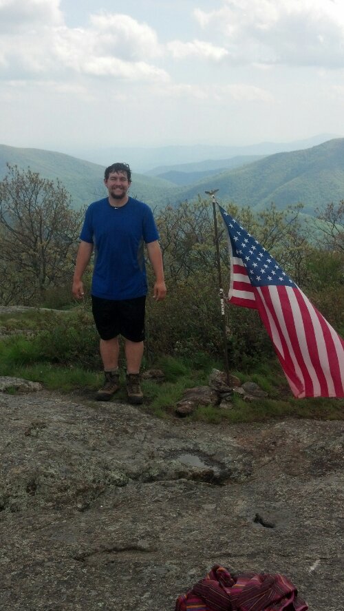
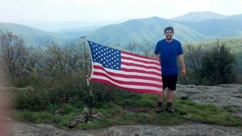
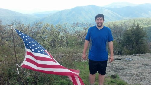
I was back on the trail around 3, and there was a group of girls getting on to the trail there too to go up and see Spy Rock. Getting on top of Spy Rock requires a good deal of rock scrambling, so I told Copper to stay and wait for me at the bottom. He ignored me and managed to climb up about halfway before reaching a wall too tall to climb. The girls who had hiked up in front of me were already on top and got some pictures of me there.
From there, it was only an hour’s walk to The Priest shelter, where I stopped and took a nap in the shelter. I slept from 5 to 9 to make up the sleep I’d missed out on the previous night and skip the evening rainstorm then we headed out into the night and over The Priest. It’s a long way down from the top and the rain kept threatening to start up again. Halfway down I slipped stepping down from a tree root and did a massive tumble that scratched up my knees, twisted my wrist, and gashed my thumb open. I squeezed the extra blood out of the thumb wound and wrapped it in gauze. When I got to the bottom and crossed the Tye, I didn’t feel like climbing the 2.5 miles back up the other side to the Harper’s Creek shelter, so I took a random side trail into a camping area filled with all kinds of enormous tents. As I started to set up my tent around midnight, the sky decided to open up in earnest. Everything got a little bit wet, but once I got everything in the tent and toweled off, it was as dry as it can be inside a tent in the middle of a rainstorm that lasts all night. Since I’d cooked supper before leaving The Priest shelter, I went right to sleep
Though it was daylight when I woke the next morning, I had zero desire to leave my tent. It had stopped raining by seven, so I finally forced myself out and started packing. The camp I’d passed through in the middle of the night turned out to be a Boy Scout troop, and the leader had seen me come in and complimented me to the troop about how quiet I’d been (as if one has to be noisy to set up a tent and sleep?) He gave me paper towels to wash the mud off my tent and offered me breakfast (which I declined) but then he (and several of the other older folks) wanted to talk to me all morning. And when he wasn’t, the volunteer trail maintainers of the Tidewater AT Club were. So I didn’t get packed and back on the trail until well after noon. And then I stopped 2.5 miles in at the Harper’s Creek Shelter for another hour, and so I didn’t start climbing Three Ridges (which has way more than three ridges) until 3 or 3:30. I stopped at Maupin Field Shelter to cook supper and weather the nightly rainstorm before moving on. While there, some ladies who were trainers for the Girl Scouts came by and informed us (for there were four hikers in the shelter) they had gotten a fire going despite the rain (and despite the utter lack of fire in the Boy Scouts’ camp up the hill) and invited us to come make s’mores, leading us through the labyrinth of campsites to where it burned.
“Sitting around a hot fire making s’mores on a rainy night” one said. “What could be better?”
“The same thing without the rain,” I suggested.
“Now you’re just being picky,” she replied.
And here I thought that “what could be better?” was an invitation to be picky. Apparently I’m not supposed to answer rhetorical questions. When she said it again later, I was silent, but in my head I was saying “Ooh ooh! Pick me! I know what could be better!”
When I got back to the shelter to pack up, I turned on the high spot on my headlamp and barely managed to illuminate the tree 10 ft. away. Yes, it was that foggy. Although it meant a 22-mile day the next day, I decided to hole up in the shelter that night with Copper and Jericho and the two friends section hiking (Easy E and ?) and get an early start.
It had stopped raining the next morning, and I was out on the trail by 8am (though Jericho had managed to pull out a half-hour earlier). The two others kept abreast of me all the way to Reid’s Gap (Blue Ridge Parkway crossing) and over Meadow Mountain, even stopping for a snack where I did, but I liked my pace and kept moving quickly all day, while I think they stopped for a long break. This section of trail was very easy, rarely having any rocks in it, briefly but gradually climbing to the top of Humpback Mountain, but then slowly and gradually descending down the back of it all afternoon. The weather was cool (though foggy and so I didn’t bother seeing Humpback Rocks) and the trail largely level and smooth, so I stopped maybe twice for five minutes each all the way down to the Paul C. Wolfe shelter (a beautiful shelter right on a creek with a picnic table and plenty of shelf space) where I enjoyed an hour-long relaxing dinner chatting and sharing drinks with Chrome Dome (he had wine and I my whiskeys). Around 5:30, Copper and I packed up for the last five mile push to Rockfish Gap. The trail remained just as easy and when I arrived just before 8pm, I called Mama from my dying phone and told her how to find me (as there was zero visibility in the fog with the sky darkening.
And then it was an hour-long drive to Harrisonburg and Copper got to cap off his first 22-mile day with a hot shower. We ordered pizza to our hotel room, made some plans, and finally got some sleep by midnight that night.
Though, my race to Waynesboro was over, I couldn’t slow down any just yet.
Next post re: the Shenandoahs: Tomorrow night???
P.S. My apologies for the lack of Copper in this post. My mad rush to Waynesboro did not leave me much time for picture-taking, especially since most of the hiking happened at night.


I love the photos of you with the American Flag. Perfect for Memorial Day memories. 🙂
Now I’m caught up.
Drove up and back on I-81 in VA a couple weeks ago. Each time I looked to the east and said hello, knowing you were somewhere north of Roanoke.
Glad to hear you’re putting in some big days. Makes me want to shoulder my pack and hit the trail.