Setting up a hammock over mud not only got my mosquito net tent dirty, it made it uniquely tricky to climb out of it in the morning. Routine for this style of camping is trying to find places to step that aren’t on your own gear, and standing hunched over due to the height restrictions imposed by the rainfly. However, you sort of come to count on the ground being there for you. I started the the morning by plopping down onto my butt without warning. I didn’t get dirty, and neither did my stuff, it being separated from the six inch deep mud bog by the mosquito net’s floor, but I did wake up very quickly. In fact, I got up before most everyone else staying there. After breakfast and toilet and water collection and purification, though, all the thru-hikers had already gone. (Six was probably gone within a few minutes of my waking. He always got up early and got out of camp in a hurry.) The college kids were a different matter. While the group leaders were up and getting everyone started cooking, some were still in their sleeping bags. So I sent Copper on a dorm raid, as it were, making him climb under the tarp and lay down with the stragglers. I don’t think they much minded, but they did start getting up not long afterward.
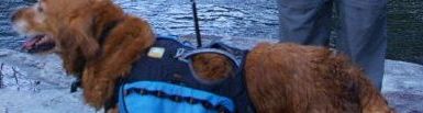
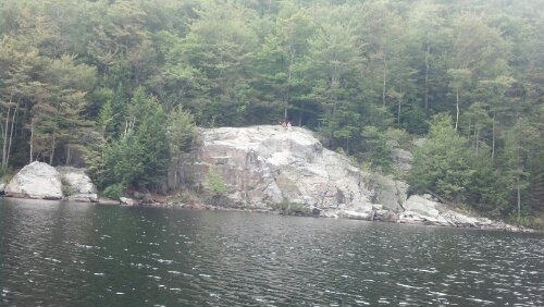
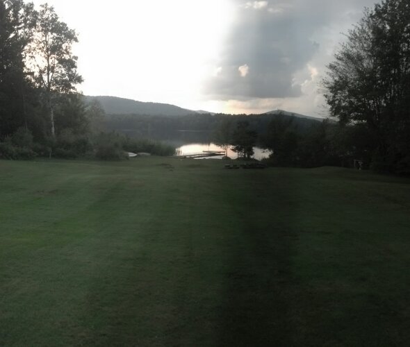
Back on the trail, I came quickly to a road crossing followed by a slow easy ascent to the Little Rock Pond Campsite. I stopped in at the shelter for a late morning snack and ended up hanging around a bit, checking out the whole area. I talked to the caretaker, who was a pretty cool guy. He said the canoe there was for anyone’s use, so I decided Copper and I would go for a ride across the pond to a huge rock which looked like it would yield the best views of the whole pond. There was a trail around the backside, but thru-hikers are lazy, so I wouldn’t have bothered if the direct route weren’t available. As far as I know, this was the first time Copper ever traveled by canoe.
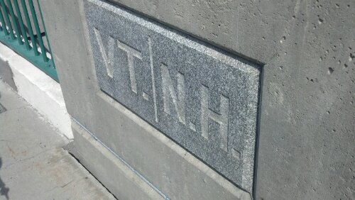
Our destination
 When we got to the rock, I pulled the canoe somewhat up onto the rocks and bade him stay on board and stay seated, which he did admirably well, though he scared me once. At the top of the rock was a father/son hiking team who had walked the long way around. They weren’t thrus and had nowhere particular to be.
View from the top
I would have stayed to discuss things with them, but I was nervous about the noises coming from the canoe which Copper was rocking around in, and I didn’t want him to accidentally push off and force me to swim after him to fetch back the canoe. I ran off so quickly I left my phone case (the same one I left at Dutch Haus and had shipped back to me in Kent) laying on the rock.
Back at the campsite, I returned to the shelter to start packing up, and a pair of older gentlemen had arrived. I took a few minutes to discuss with them as I snacked a bit more and packed up my stuff again. By the time I was ready to go, those guys I saw on the rock had hiked around to return my phone case to me (and this was the first I’d realized it was gone)! Thanks, dudes, whoever you are.
So, after probably three hours of hanging out by the pond, we finally hit the trail again, up and over a small gently-inclined mountain. Coming down the other side, we wandered right into an unexpected wonderland. Well, unexpected to anyone who never reads trail blogs (which includes myself). A legion of hikers has collected and stacked and balanced the myriad White Rocks which lend their name to a nearby Cliff. Some have even made signs for the place. 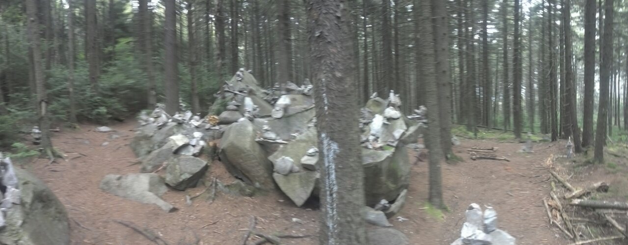
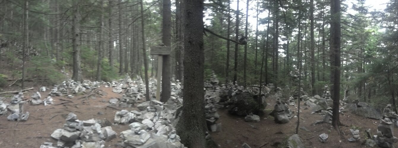
The signpost marks the side trail to White Rock Cliffs
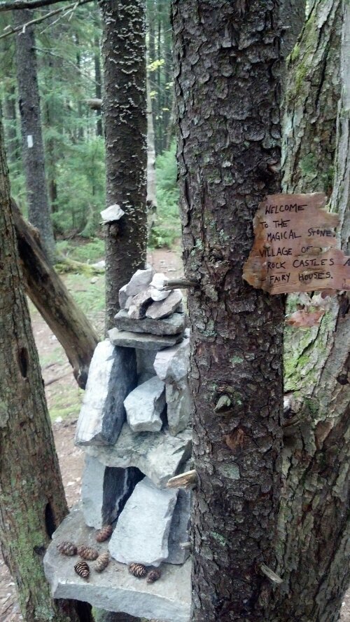
Note the white blaze in the background
About a mile from here was Greenwall Shelter, and after five miles of nonstop hiking, I was ready for a bit of a break and a snack and maybe a water refill. But I wasn’t nearly so worn out as the old out-of-shape guys I met there. As I recall, one of them was sick or injured, and they were stopping for the night even though it wasn’t even 5pm yet. I’m sure I considered staying, but even though the clouds were making it somewhat of a dim afternoon, I figured I had just barely enough light and energy left to make it to the next shelter. I bade adieu, put on an audiobook, and began marching with some haste back to the trail and then down the hill.
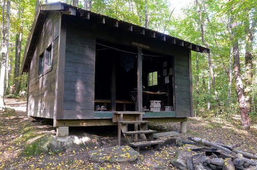
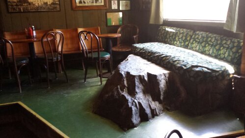
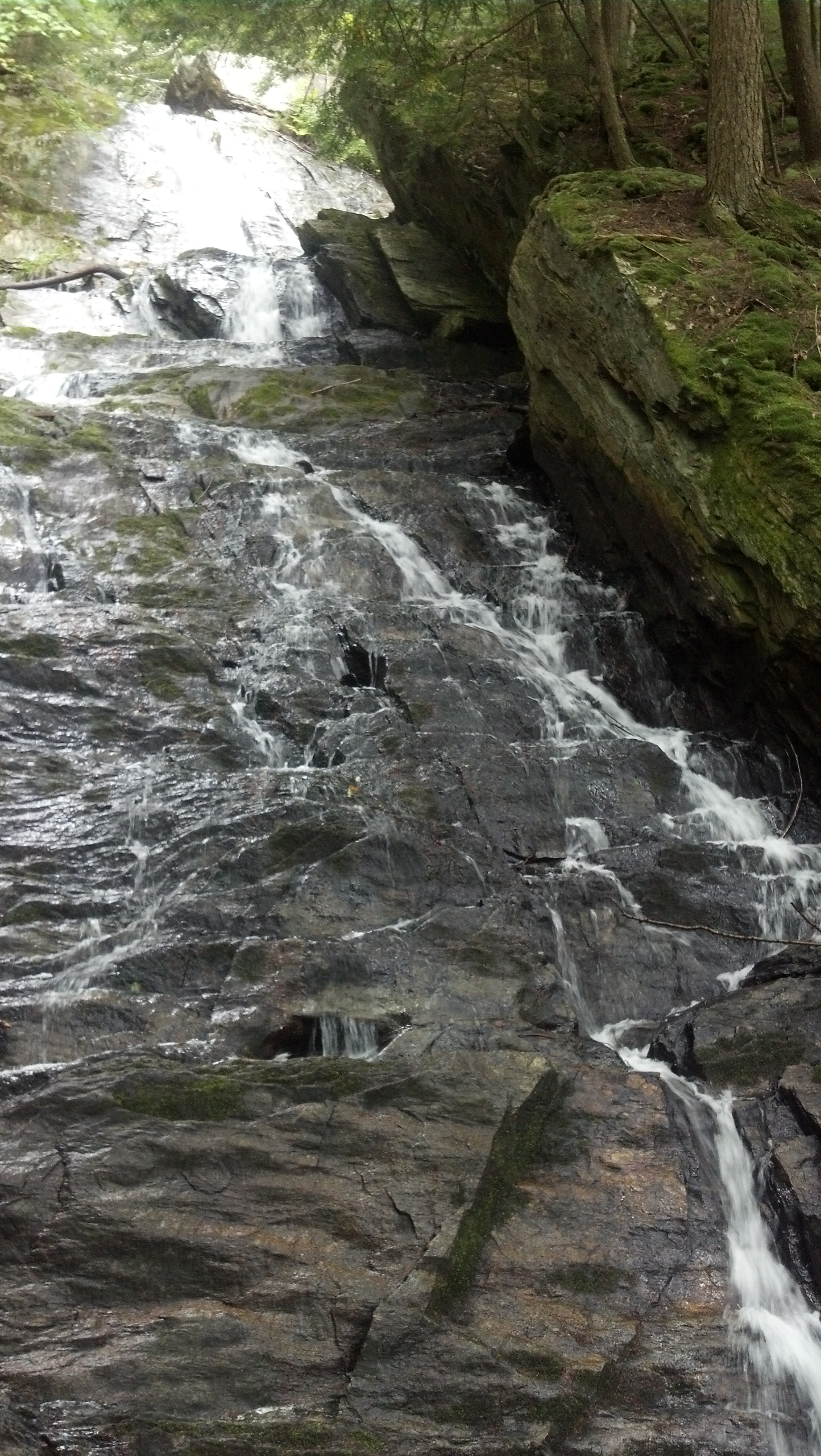
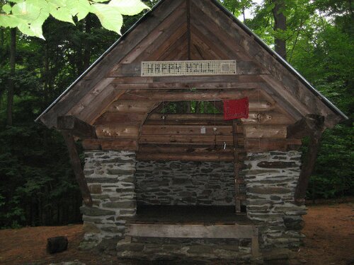
When I got to the Bully Brook crossing, I didn’t even slow down to take a picture of the waterfall just off trail, if I even noticed it. I had about five more miles to go, and the sun went away pretty quick. It was mainly climbing and descending yet another “Bear Mountain”, and not much interesting about it. I arrived at Minerva Hinchey Shelter probably around 8pm. The trail opened up into a wide road-like intersection right before it, and it was kind of unclear how to find the shelter, but a couple who had already turned in directed me to it in the dark. When I found it, there was already another guy there, just getting started cooking. The shelter was yet another unique design, with a single shelf and a built-in table.
The stacked concrete block “chair” is where I sat to cook.
Following the other guy’s directions and the map on the shelter wall, I led Copper to the water source, and collected some to use for supper. It was a lot easier to find in the dark than usual, because where the map had said “H2O” corresponded to a tree with the same spray-painted on it, and likewise for the tree labeled “WADA”.
When I got back and got supper cooked (and Copper served and medicated), the other guy decided to go out and look for the privy. He must have wandered for half-an-hour, picking the wrong path and making a huge circle, enough to make me worry before his headlamp came bobbing back through the night. I don’t recall whether he ever managed to find the privy or not. Eventually, without any fanfare, we both settled down on the shelf and got some shuteye.
The next morning, I woke up at dawn, got myself together, and got on the trail before 8am. I had a huge 16-mile day planned, and couldn’t waste any time. Or, that was my plan at that particular moment anyway. Three miles down the trail, there’s a suspension bridge over Clarendon Gorge, and the river through it is known to have a number of swimming holes. However, the temperatures were already dropping at that latitude, and it was not even 9am yet on a vaguely cloudy day, so swimming seemed right out for me even if I didn’t feel like my time that day was limited. But not for everyone. 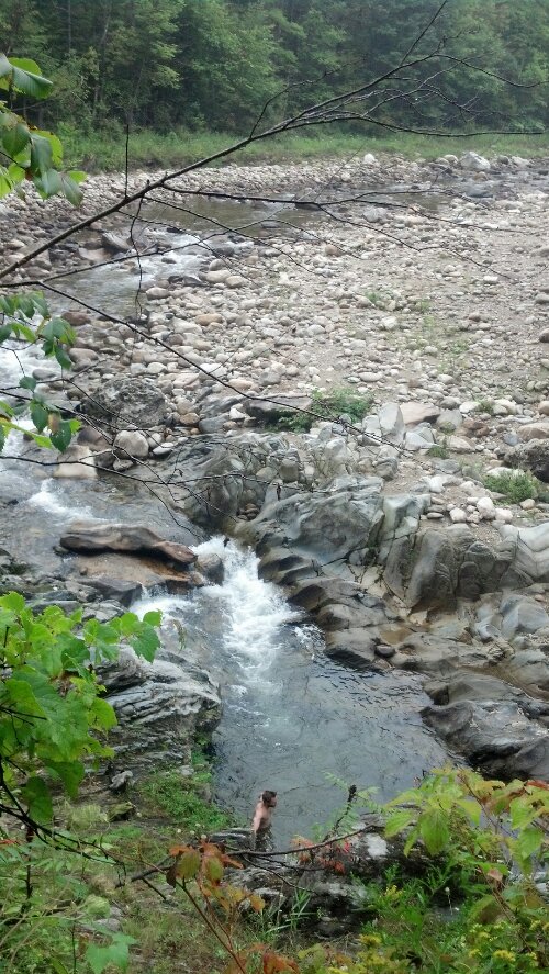 I crossed the road just beyond here and a couple of miles later, arrived at Clarendon Shelter.
 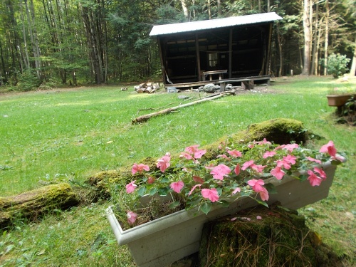 It’s an enormous shelter in a huge mown clearing, decorate all around with flower boxes. I stopped here for a snack and discovered a pile of papers and books. One was a book called Gone to Earth, set in the Berkshires, through which I had passed just a week before, a cheap easy thriller about a mass murder. Having finished my audiobooks, I picked it up. (You’ll recall I did the same with that Nazi thriller back in the Mt. Rogers NRA.) Another was a brochure describing in great detail the hiking trails up Mt. Killington, over which I’d be going that evening. But most distractingly was a newspaper with an unfinished crossword in it. I ended up spending more than an hour adding words to that puzzle and correcting the ones the previous owner had gotten wrong. For instance, what is a three-letter acronym for an organization of doctors, with M as the middle letter? I found “AMA” inked in the blank when I arrived, but that was wrong. Any guesses as to the right answer?
I don’t remember if I finished the whole puzzle, but it was probably noon by the time I hit the trail again, having lost a large chunk of my day, which I would have to make up that night. Back on the trail, I had a short climb over Beacon Hill, a descent to another road crossing, and then it was back up again for the rest of the way to the top of Killington. As I recall, there were signs here talking about how significant portions of this section of trail had been destroyed by Hurricane Sandy, but it was fine when I went through, and the streams and such were a joy to walk over, or in Copper’s case, through.
About a quarter of the way up, I stopped in at Governor Clement Shelter for lunch and a water break. There weather wasn’t hot, but it was quite sunny, and I was dripping sweat, so it felt good to take a breather and do some log-reading. I didn’t want to stay too long though, as I still had a four-thousand-foot peak to climb before sunset. 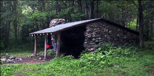
Unfortunately, after I was there for a few minutes, another guy came up and he was very chatty. He seemed to be a bit out of shape, and I think he was from the South. He showed no signs of wanting to leave that shelter the rest of the day. I don’t know how I made it clear to him that there was no chance I was staying a minute longer, but we managed to leave after a 30 minute break at most. Then, it was time for the long haul up Killington.
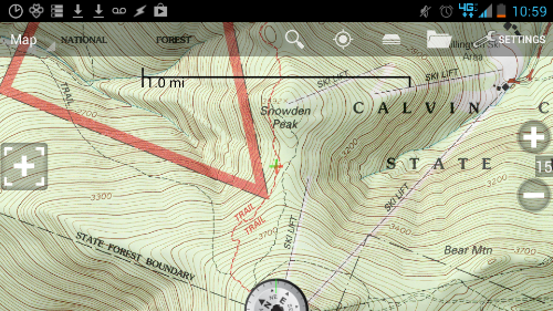
Getting up into the alpine zone, we finally got a hint of how interesting the trail would get over the next month. I passed a small lady going the same direction whose pack was covered with trail and hiking patches. She thought the trail was very difficult and that it was taking quite a long time to climb the mountain. I was having a great time. At a couple of places, we had to climb up rocks in the trail, and I had to help Copper a little, but it’s always fun to watch him pick his own path through technical sections. It’s hard to describe exactly how much climbing there is up Killington. It’s just up and up and up, and when you finally get up on the ridge there’s still a long distance to go through woods to get to Cooper Lodge, which is more of an old boarded over ski lodge that they’ve been talking about tearing down for years. It has to be strong way up there because it gets completely covered by snow every winter. 
Here, I dropped my pack and left Copper in the shelter with his supper and the other two ladies who were already there, and ran straight up 0.3mi. of steps and rock faces to the peak to see it before the sun set, though I made it with plenty of time to see it. I made a video to commemorate my first time above four-thousand feet since The Priest way down in Northern Virginia:
When I got down to the Lodge, I found Blockade Runner and High Tide setting up camp, so I let them know they should try to see the top in the morning, and then I went inside and put together some tuna sandwiches with some of that Vermont Cabot Cheddar I picked up in Manchester Center in order to energize up for five more miles. Despite the chill in the air (which comes with the wind and the 4000 feet of elevation) and the protests from the other two ladies there (who reckoned Copper didn’t want to go on, and may have been right), we headed out on the trail again with headlamp on.
The part next to the crosshair is where we came stumbling through the woods.
Less than half a mile into the woods, we came out onto a ski slope with no clear way to go on. We hiked up and down this section of slope about four times looking for a path out. There wasn’t one. I decided to just follow the slope all the way down to the road that crosses it. Still no trail. I sat down under one of the pole supporting the ski lift and turned my phone on and looked up the trail on Backcountry Navigator. Turns out the trail took an unexpected turn downhill before the ski slope started. According to the map, the trail came back close to the road halfway between Killington and Snowden, so I decided rather than climb all the way back up the ski slope again, I’d go down to that point and cut into the woods.
It turned out to be further off the trail than it looked on the map and it was thick tight forest, nothing but pines and furs, half of them laying over on the ground, nothing like a trail. It was even more fun here watching Copper pick a path to follow me. Eventually, we found the trail again, and I found a good oldies station on the radio to power me through the rest of the night. I turned off on the Sherburne Pass trail when I reached the bottom of the mountain, but I still had a half mile to go to reach Pico Camp. The trail ran mostly downhill or level, crossing or running along a number of roads and ski slopes. Judging from the city lights I could see from the clearings, the trail must have had beautiful views in the daytime.
I came into Pico Camp right around midnight. I could tell right away I wasn’t alone. There were pots and plates scattered across the top of the boulder outside the door. I climbed up on the stoop and tried to go inside, but the door was locked from the inside. Imagine a shelter with a locking door!
I knocked enough for someone to wake up and come open the door in his underwear. The place was packed tight with four people on every shelf. Another college group. I had been expecting such a remote shelter empty. He told me that it would be fine if I moved all their stuff around to make a spot on the floor for Copper and me, and I was happy enough to get it, because it was still pretty chilly out and all those bodies inside made it pretty warm. Probably the floor was the most comfortable spot in the room. I went ahead and pulled out my sleeping bag and laid it out, then headed back outside to cook on the stoop. (I left Copper inside to go ahead and get some sleep.)
I think I must have made pasta that night, because, as I was scraping the noodles off the bottom with the spoon to keep them from sticking and burning, the entire head of my long-handled aircraft aluminum spoon snapped off. This would have been devastating normally. The only other thing long enough to reach the bottom of my JetBoil pot is a stick, and it’s hard to eat with a stick. This time, though, I was fortunate. Among the pots and pans on the rock was another spoon exactly like mine. So I went ahead and used it to eat my pasta, cleaned it, put it back where I found it, went inside, and crawled into my sleeping bag.
In the morning, I was the first one up. I couldn’t sleep in if I wanted to, as I was sleeping right in the only path to the door, but trail people get up a lot earlier than college kids, so I don’t think anyone else woke up until I started packing. I wasn’t the first one to the privy, though. I had to go collect water and make breakfast before my body would be ready for that, and most of the students had awoken by that time. After I made my own visit there, I reported to their trip leader that I’d had to wipe something decidedly brown off the seat, and so he went ahead and explained to everyone—at risk of treating them like children—the manners and virtues of keeping the privy tidy.
On the bright side, when I asked him about the long-handled spoon, thinking perhaps I could buy it off whomever brought it, he said he thought they’d just found it lying around and I could probably just have it for free. What a boon! Later, when I was about ready to leave, he asked if I’d gotten it. Not seeing it anywhere on the rock where it had been, I assumed I’d packed it, and affirmed. I packed up nearly on auto-pilot at this point, and hadn’t actually noticed what I’d done with it one way or another, but it clearly was not around. I found out later I hadn’t packed it.
When I arrived in Killington that night, I was spoonless. In any case, we hit the trail again. The Sherburne Pass Trail, that is. About the time I was leaving, Blockade Runner and High Tide came walking through camp. The husband-wife team had also chosen to skip Maine Junction in order to head straight down to the Long Trail Inn, where they had reservations. We got ahead of them and booked it down the hill to where the trail crossed the road and sideswiped the Long Trail Inn. (Here I met a old Chinese couple who were looking for a particular trail to a particular view, and I had to study their map carefully before I could inform them that they were on the right trail, but the wrong side of the road. It only delayed me a few moments from my goal.) It was so early, the Irish Pub had not opened yet, so I sat down in the chairs on the lawn and got out my phone to do a little blogging, letting the sun charge my solar battery. 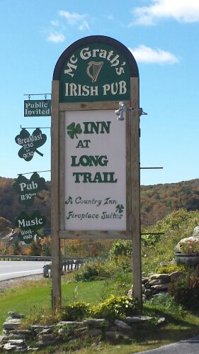
Blockade Runner and High Tide finally got in about an hour later. I forget what took them so long. I was hoping they could swing me a shower in their room before I had lunch in the Pub (because cleaning up before entering a public venue is basic hiker manners), but it turns out the lady that runs the hotel has a zero tolerance policy on anyone but room-renters using the showers, and the only way to get to their room on the second floor would be to walk right in front of her. I don’t really understand this policy, personally. Plenty of motels along the AT take advantage of their unique position to sell showers to hikers. In fact, just a mile further up the trail was a State Park campground with coin-operated showers that probably makes a killing off of transients. But having to go in smelly wasn’t going to discourage me from getting lunch with some beers.
I put Copper and my pack in the woodshed at the end of the first floor, and spent a half and hour in the lobby waiting for the Pub to open. They have a room full of puzzles and games and toys in there, quite an interesting collection. They had a game where you pump water into little jets to shoot rings onto pegs. They had one of those “Shoot the Moon” toys where you try to get the metal ball into the nearest cup by separating the rails on which it rolls just the right amount. They had tons of books and brochures and posters. Not your usual lobby.
When the pub opened, I got a place at the bar and ordered myself some lunch and a beer. I chatted with the lone bartender (the son of the proprietors) about what business was like in this part of Vermont and how the seasons worked. I remember trying a Long Trail Bear-y Wheat here, which I didn’t like quite as much as the standard Long Trail Ale, but it wasn’t bad. One of the interesting aspects about this pub is the enormous boulder that it is built around, presumably because the boulder would have been difficult and expensive to cut and haul off. 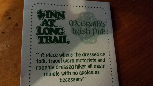
All pictures from the Long Trail Inn are by Karen Rutter
I finished up a little after noon and went out to get my pack and my dog and get back on the trail. The Sherburne Pass Trail continues running the edge of the hill behind the Inn until it finally meets up with the A.T., which turns east from the Long Trail at Maine Junction. Less than a mile after that, it joins a road in Gifford Woods State Park. In a campsite near this junction, several other hikers had already gathered, sorting through their stuff and making plans. I didn’t really know any of them, but they were nice enough, and told me how to get to the shower. I left my shirt hanging from my poles in the sun to dry and Copper in the campsite with them when they said they’d be there until I got back from the shower. I don’t remember what happened exactly, but I think Copper wouldn’t behave for them, and tried to get down the hill to me, and they had to physically restrain him to get him out of the road. I didn’t mean for him to be a bother. Usually, he does exactly what I say. But I was only gone for a half hour or so, most of it spent waiting on the shower to open up. It doesn’t take long to take a shower when 6 minutes costs a dollar.
After getting some water from the spigot, we started walking again. A thousand feet after crossing from the entrance of the State Park to the trail head on the other side, we turned right off the trail, where I hid Copper’s and my pack in the grass, and walked into the town of Killington. I needed some more dog food and cheese and such, and of course, a new spoon.
While there are many sport shops in Killington, they are targeted to skiers and were all closed. But there was a small grocery/convenience/liquor store, and I did my small resupply there. I think there was a brief sprinkling of rain when I arrived, but I had Copper tied off to a gas pipe so he could get under shelter if he wanted. He didn’t want. He doesn’t mind wet. The town of Killington was getting ready for their Hay Festival, and I talked to some folks there who were building hay bale sculptures. It seemed more like something the town did for its own amusement at the end of the summer season than any kind of tourist attraction, though the sculptures were tourist-friendly. A bear with a camera, shown in a photo by the Vermont Standard, was the one they were working on when I spoke to them. I returned to the trail the same way I came: a half-mile of road-walking terminated by a right turn into a briar-riddled patch of weeds beside the creek.
Just a minute or two down the trail to Kent Pond, I bumped into a strangely dressed couple (as in she was wearing parachute pants) who wondered where the A.T. was. I informed them they were standing on it. He told me they’d never been up that way before, and that they were from the Yellow Deli in Rutland. Had I heard of it? Of course, I’d heard of it. There were several reports of people going to stay at the hostel and getting sidetracked for days by the “Cult of the Yellow Deli”. I took this reports as joking exaggerations about the friendliness of its proprietors, but I later heard that it actually really was a cult, and I may have offended that couple by referring to is as such in their presence (though they didn’t seem like it). The group who runs the America’s various Yellow Delis is trying to recreate the 1st Century Church as described by Paul in Acts, and staffs its delis with volunteers, who in turn get free room and access to delicious sandwiches. In the case of Rutland, most of those volunteers are thru-hikers. In fact, I first heard about all this from Six and Dangerpants, who managed to get sucked into the Yellow Deli vortex for a couple of days and were now actually behind me on the trail. Eventually, I said goodbye to the strange unsmiling Biblical couple (and so did Copper) and I kept walking down to the pond.
I had no idea what my plan would be for the night, as I had already showered and resupplied and the next shelter was miles away. And it looked like it was going to rain. But Awol’s Guide said that the Mountain Meadows Lodge allowed hikers to camp for a reasonable price, and when I saw the place—the trail runs right across their immense lawn—I knew that would be where I spent the night. A grand total of about 4.5 miles for the day. Woohoo, Nero!
The view from the Adirondack Chair

And one with the clouds visible
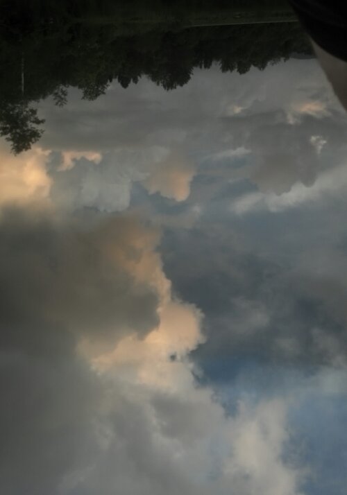
I dropped my stuff in a large Adirondack chair to get it up off the lawn, as there was a guy riding around the property on a mower, and went in the lodge to try and check in. There was no one at the desk, just a sign saying he was on the grounds. I assumed he was the guy on the mower. So Copper and I made a trip or two around the grounds, tried the apples that were growing everywhere, remembering when the place was an apple orchard (too bitter), and when he still hadn’t finished mowing, I went inside again, leaving Copper on the front porch. There was another hiker in there, eating and putting in a movie. I introduced myself. I forget his name, but I sat in there with him for a while, glancing at a book I found, before I got bored and went back out to see about checking in. He was still mowing. So, I walked down to the pond, and took pictures of the clouds over the mirror-calm pre-storm waters. 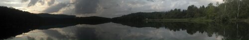
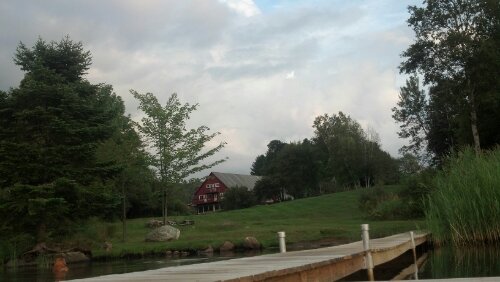
The red barn-shaped building is actually the Lodge, and a very popular wedding venue. And Copper, of course, can’t resist the water.
Yes, this is right-side-up. The bank of the pond is at the top, and everything between is still, calm water.
Eventually, I heard the mower turn off and went back to the Lodge just as the guy was getting in. He apologized for not coming sooner, as he thought I had already checked in, possibly with someone else. He told me how to get to the campsite (because I hadn’t managed to spot it myself) and that I could pay in the morning. I went down to the campsite and hung my hammock and gave Copper his supper. I returned to the Lodge to inquire about a spoon, and he lent me one from their dining room. So, I proceeded to make supper on the picnic table outside. Just as I was finishing cooking, the thunder started becoming audible and the rain started sprinkling. Copper came up and started bothering me and sticking right by my side, so I took him down to the hammock and trapped him inside the mosquito net, then carried my pot and my supper back to the lodge to eat and clean in the kitchen. I convinced the caretaker guy to open up the bar, because I had no desire to go run through the rain to get to bed when I wasn’t even tired yet.
I had a couple of Long Trails (two different ones as I recall), while we chatted about the wedding venue business and the other events and meetings they hold, and about one guy (possibly the owner) who is just absurdly good at piano (of which there is one in the bar/lounge). We talked about the difficulty of pleasing everyone in a wedding party of 100 when providing the banquet for them. I heard plenty of stories about guests that come walking right through the lodge in their ice spikes in winter, having brought their entire noisy family of kids, every winter, and how sometimes it seems it would be easier just to ban such obnoxious “regulars”. And a story about a young wedding guest that made friends with my barkeep pro tempore, made a college connection, and came back later to let him know he got in.
I think it was probably around 10pm by the time the rain had passed by and I decided to head to bed. Copper was still in the hammock tent, but the there was a giant rip in the floor, which I have yet to fix, where he tried to dig his way out to escape from the thunder. This is also the night I realized my water hose magnet had fallen out of its pouch again. I set it on top of my pack below me because I figured it would be unwise to put it next to my phone in the hammock pocket. In the morning, I forgot, and knocked it on the floor, and never found it again. It probably fell through Copper’s hole when I was packing up. Too bad. It was a super-nice magnet.
However, the Lodge was great in the morning. There was breakfast! Also, I got a plastic spoon to take with me, and bought one beer to go when I checked out. Nothing like having a beer in the woods. It was late morning by the time we were packed up and I led Copper into the woods away from the pond. At first, the trail here just crosses a number of roads, then descends quickly to the Thundering Falls area. The guy at the Lodge had warned me that every time he’d taken guests over tot the falls, it had been disappointing due to the owner of the cabin above it diverting the stream for private hydroelectric generation, but I wasn’t that disappointed, and none of the other tourists hanging around taking pictures seemed to notice either. 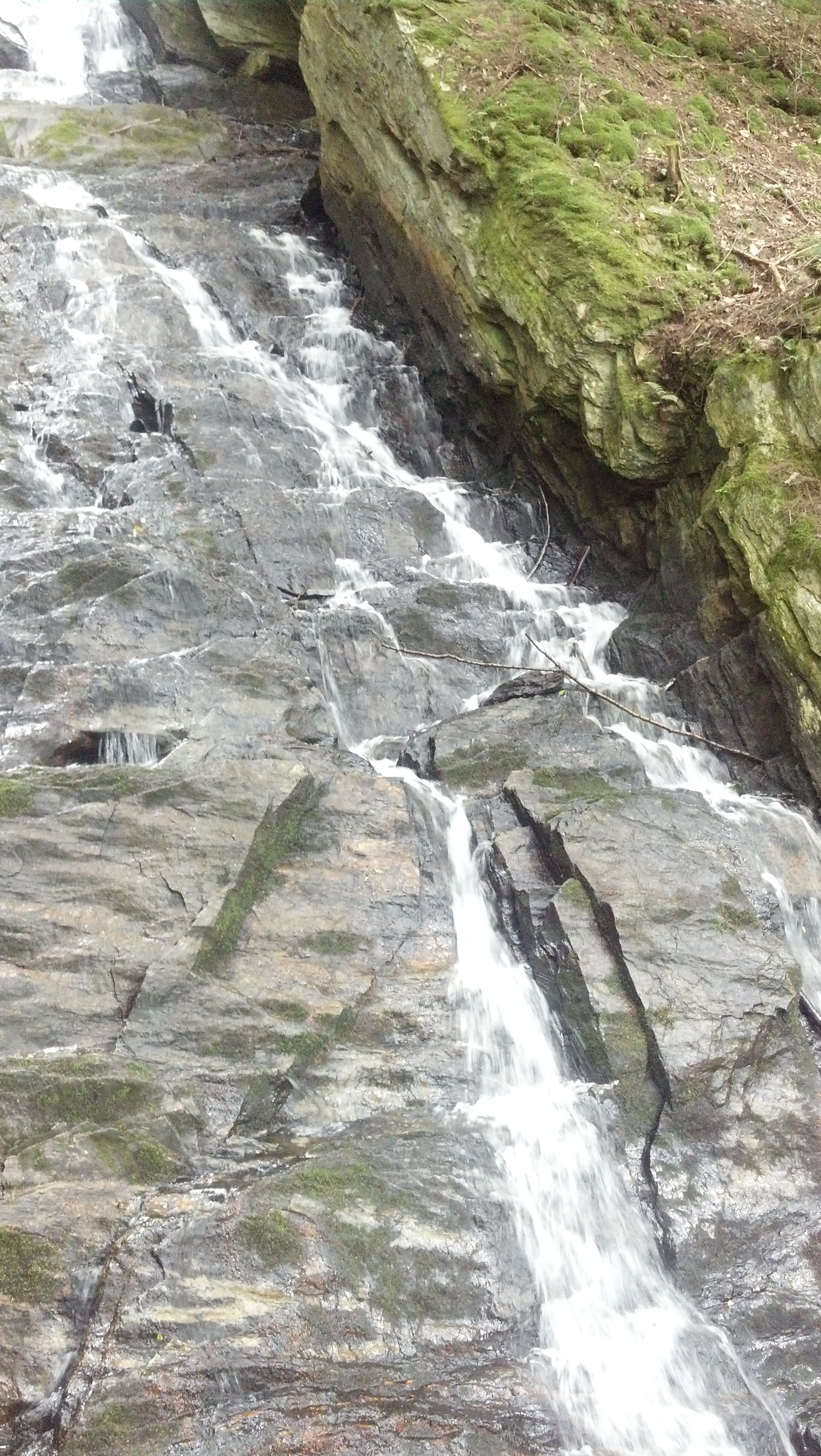
 The trail then crosses the stream and follows a boardwalk to another road, and a short way down this road, it turns back into the woods and goes straight up the side of Quimby Mountain. I remember having been dreading this climb somewhat, since it seemed awfully steep on the map, but of course it went by in an instant. The Lodge guy had said there was a view he used to visit (besides the power line cut on the A.T., which I apparently thought was not impressive enough to warrant a picture), and it was a clear day, so when I got to the top, I took a left on the gravel road and went down it for a little way.
After a few minutes without getting anywhere interesting, I turned around and started heading back up, since I didn’t think it’d be a good idea to go a mile out of the way chasing a view I wasn’t even sure was there. On the way back up the road, an SUV passed me coming down and, seeing as how Copper was walking right up the centerline, they stopped. I think they offered us both some water and I accepted. I do remember they were driving down to a hunting camp their family had established somewhere down the side of the hill. Eventually, we went our separate ways.
Just down the other side of Quimby, I decided to stop in at Story Spring Shelter for water and lunch. It was mid-afternoon, and the place had already been taken over by an orientation outing from Dartmouth. They told me where the bare trickle that passed for a water source here was, and when I returned from collecting, I joined their conversation while filtering it. I soon found myself invited to join a game of Mafia. Apparently, not everyone agreed with this idea, as I was the first one hanged. I think the mafia won that one, but it was a lot of fun to watch while I ate.
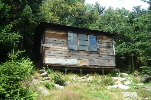
It was late aftenoon by the time we left, but I had already informed everyone I wouldn’t be staying. I had set my sights upon Winturri Shelter for a 16 mile day. With the late start and all the socializing, though, the sun was almost set by the time I arrived at the Lookout, a private cabin on top of a mountain that allows hikers to stay. This is what it looks like in the day time: 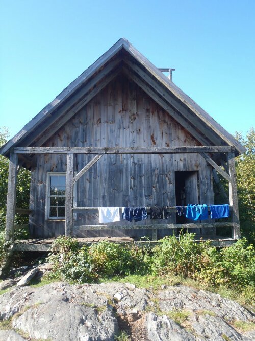
It is named for its rooftop platform, accessible from a ladder on the side: 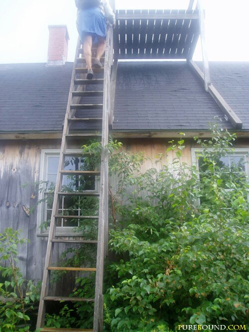
As soon as I arrived and dropped my pack, I pulled out the beer I’d been carrying and tried out the platform. The sun was already down and a fog was rolling in, so it looked kind of like this:  Or without flash:
  If I’d managed to arrive before sunset and the onset of fog, it would have looked like this:
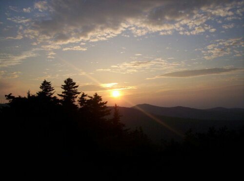
Nonetheless, in spite of the chill in the air that chased me off the perch as soon as I finished the beer, there was something ethereal and compelling about the fog’s interaction with the night. I wished I had a camera capable of capturing high quality low light images. Back down on the porch, Copper and I had supper. Then, I found a spot inside the cabin loft, while he slept just inside the door. It wasn’t so cold in out of the wind, even though no fires were permitted in the cabin. I woke up several times this night hearing the sounds of mice, and once even moved a can that had been filled with trash and food wrappers outside the door to give them one less thing to mess with. If that weren’t enough, one of the other five people staying there was awfully snorey that night. But I managed to get a good night’s sleep in somewhere before dawn.
I woke up right at dawn actually, and gulped down the rest of the water I’d flavored the previous night. It was the last of the water I had, and I was getting hungry. I’d need to get some water before I could have breakfast proper. I was one of the first ones up, despite all the light flooding in through all the east-facing windows. I tried to take a wide angle picture of the cabin interior, but this is all my phone could come up with:
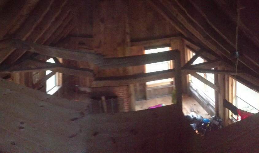
I think I turned it off quickly to save battery, not even noticing it hadn’t turned out.
I packed Copper and myself in as much haste as I could muster, ate a breakfast bar, and got back on the trail, and did the 2.5 miles to Winturri before I even noticed. My speed was motivated in part by the fact that, in addition to needing water to make my morning milkshake, I needed the one big thing the Lookout lacked: a privy. Winturri Shelter was occupied by several hikers I knew, who were making the most of their morning. Some had barely awoken when I arrived. I didn’t really waste any time here, though. I got breakfast and business done, then left again.
We were all excited, I think, about the prospect of the farm store at the next big road crossing. It was only 3.5 miles gently downhill to the road, over the creek, and a few tenths of a mile to the left. A number of other hikers were already there when Copper and I pulled in. I went on in to the cool air-conditioned store and started investigating the selection of farm-fresh groceries.
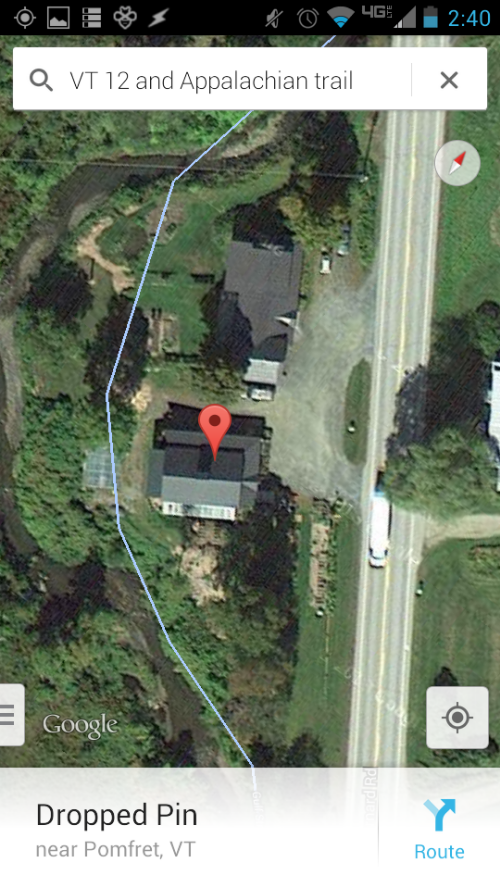
The Trail crosses Gulf Stream via the suspension bridge on the left, then re-enters the woods via the beaten path through the field on the right. Google Maps is oblivious to the trail’s actual location in this neck of the woods.
On The Edge Farms Store
I picked out some deli meats and cheese I could combine with my Sandwich Thins and the complimentary condiments to make several lunch sandwiches. I also got some bottled strawberry lemonade and some other berry soda I’d never tried. After I made and ate those sandwiches, I got some ice cream and cookies and went out to join Six where he and Copper and some other hikers were hanging out at a picnic table. I think Six was trying to eat an entire apple pie, though maybe it was someone else, or maybe someone was sharing it. In any case, everyone was having a grand time all doing the same thing: eating.
At some point, Uncle Buck showed up. He had quit the trail somewhere down South and become one of those trail angels that chase the hikers north, providing rides and other magic. He and his tiny rescue dog had driven out this way from New Hampshire to yellow-blaze some folks ahead to Hanover. I asked if he’d be around this way the next day, hoping to get within slackpacking distance of Hanover so I could go in early and get my package from the Post Office on Saturday and avoid the two-day wait over the Labor Day holiday.
“Nope,” he said, flatly. Oh well.
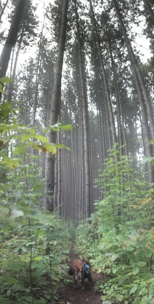
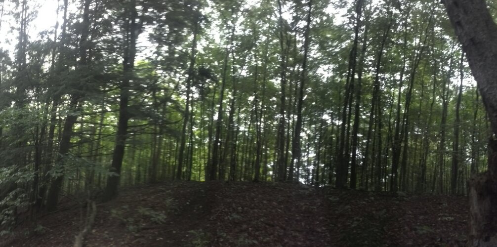
I was probably at the store and eating things for around 3 hours before I packed us up and we headed back toward the trail. We hiked continuously for the next eight miles, and the trail was mostly typical Vermont. Which means it was anything but boring if you paid attention. (Dangerpants, a latent geosexual if there ever was one, had signed log books throughout the state with the catchphrase “Lovermont”.) At some point, the stratification of the forest and the thick uniformity of the trees touched some aesthetic instinct in me, and I found myself stopping just long enough to take pictures of scenes that probably ended up capturing no sentiment deeper than “You had to be there.”
Later, we crossed the road where Cloudland Market was, but I had spent enough money for the day and was probably still mostly sated from my super lunch. We kept on straight. We passed the side trail to Cloudland Shelter, which is on the Cloudland Market’s property, but even though it was nearly sundown, it was only two miles to the next shelter, so we put on the gas and went on. (The second picture above is from the top of the hill between Cloudland and Thistle Hill Shelters.) We came into Thistle Hill Shelter just about sunset, and there were other people there, but I don’t remember who. Perhaps it was Kobe again, because I know I saw him twice on the trail. Perhaps Six was there, I did catch up to him the following morning.
There isn’t really much interesting to say about the shelter itself, but I did get to see something unusual in the morning. It’s one of those shelters with a strangely-shaped privy:
I didn’t linger too long there in the morning, because I was excited to be getting in to West Hartford, which has another one of the longer road walks on the trail in order to get under the Interstate. There are actually three different roads on this roadwalk, featuring names like Tigertown Rd and Podunk Rd. In case it isn’t obvious, West Hartford is a very small town, but it does have one thing in it, right on the trail, that every hiker is looking forward to: the Full Belly Deli. And they know it too. In fact, they have a rack out front with a row of pegs for hikers to hang their packs on.
This photo, and the sunset from The Lookout above are from 2012 hiker Luke (trail name unknown), whom I do not know, but who is definitely a kindred spirit. He took pictures of what I did, plus the things that I should have, or wish I could have. Click on this picture to check out his site.
When I came up to it, Six was sitting on the front steps, having already finished what he described as an enormous and amazing breakfast sandwich. I went in to get one, but it was already 11am, and breakfast was no longer being served, so I just got the day’s special: an overloaded meatball sub. I also got Gatorade, a giant pickle, and a few other items. And I also found a printed brochure of things to do while in Hanover, along with a list of people whom one could stay with for free or get rides from in town. Very useful.
I joined Six on the steps to show off my findings and eat a bunch. This is where I learned of his adventure with the Yellow Deli Cult. It didn’t take long to eat, but it did take long to leave. I charged my phone, and then called home, walking around beside the store until it started raining, ever so slightly, as it was one of those super-muggy, sprinkly days. I took refuge under the eaves, and digested, then went back in the store to get another drink and dessert. Copper and I didn’t leave until after 2pm, though Six was long gone. Three miles after the trail dove back into the woods, I stopped in at Happy Hill Shelter to do some log-reading. I found entries from both Six and Dangerpants, the latter of which I hadn’t actually seen pass. Both indicated they were trying to get into Hanover that night. As the Post Office was already closed, and I was close enough to reach it in the morning, I had no pressing need to get there. In fact, it would only cost me more money, since I would have to stay there until Tuesday to get my package either way. In addition to my low motivation, it was about to storm, and Happy Hill Shelter was cozy and closed in.
So, never mind the fact that I’d only put in 9 miles. Copper curled up in the back and I had my stuff unpacked and sat just back from the edge of the eaves and fixed a snack. It didn’t take long to decide to stay. Two 16-year-old girls arrived together in the middle of the rain, all bundled up in raincoats, clearly inexperienced with the whole backpacking thing. At first, they started to set up tents, but decided it wasn’t worth it in the rain, and came in to take the top shelf. We didn’t really talk much: they kept to themselves and each other. I just got in my sleeping bag and napped next to Copper until the rain stopped. There was thunder, but he wasn’t as panicky as usual with me next to him on one side and the rock wall on the other. When it stopped, it was dusk, and I went back up to the edge of the platform (which was shaped like a small proscenium stage—I mused about the possibility of putting on small plays while I was there) and made supper for myself and Copper. Then, I laid down with Copper and listened to the radio until I drifted off to sleep again.
I woke up at dawn the next day and went to fetch water, which was a long way off. When I got back, the girls had already gotten up and started getting themselves ready to go. I, myself, was eager to get to my town day. It was an easy downhill stroll four miles to the beginning of the long road walk through Norwich into Hanover. I passed a bunch of day hikers randomly walking into the woods due to easy access, but none of them are particularly memorable—not even the one who wanted to know where she was and where she was headed. Elm Street starts with a super-steep downhill, past Betsy Maislen’s house, which always keeps bagels and others snacks in a box by the mailbox, courtesy of Dan and Whit’s General Store. The road eventually bottoms out and curves up again, landing at one of Norwich’s main streets a mile later. (If you’ve never heard of Norwich before, it’s probably because it’s just a suburb of Hanover, despite being in a different state. However, if you were watching the Olympics in Sochi this winter, you might have seen Norwich resident Hannah Kearney grab a bronze in Women’s Freestyle Skiing—Moguls. Go Team USA!)
When Copper and I arrived there, there was some kind of kid’s field day gearing up in the park across the street. We turned right, and headed down the hill, and under the highway. (I think I said that Dalton had the longest road walk on the trail in an earlier post. I just checked and I was wrong. The Norwich/Hanover roadwalk has it beat by a bit over a half-mile.) At the bottom of the hill, we came to the Connecticut River, and by crossing it, left the Green Mountains for good, and put ourselves on the borderlands of the White Mountains National Forest. Despite the fact that the trail through the Whites is only 150 miles long, we spent nearly as much time in them as we did in Virginia (500 miles)…and it was probably a lot more exciting too. But first, we had a few town days of relaxation to build up our strength for the tough times ahead.
P.S. Sorry this post was so long coming, but, as you can see, it’s a very long post with many images. Due to some glitches in the WordPress Android App, I had to remove all the pictures and edit them in directly from the web interface, removing placeholder text in the process. The memory and software requirements forced me to switch devices three times before I found a computer sufficiently powerful to edit this post, and I’ve been through it fixing and refixing things so many times now that some kind of mistake is unavoidable at this point. If you see something strange on this post, please mention it in the comments. In the meantime, I already started the next post. It shouldn’t be nearly as long, so you can expect it in a bit more than a week.
Additionally, several folks are planning to head up to North Georgia on March 9th to have a Trail Magic Party. Anyone who has read this far and has the time is welcome to join and help out, and I’ll document the event in one of the next two posts.
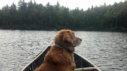
That picture of Copper in the canoe is great! We tried to take him out in the canoe at the lake and quickly came back to the dock—-he was too wiggly and we were afraid we’d be tipped in the water in under a minute!